Huacachina – Yay sandboarding!

IMGP1118

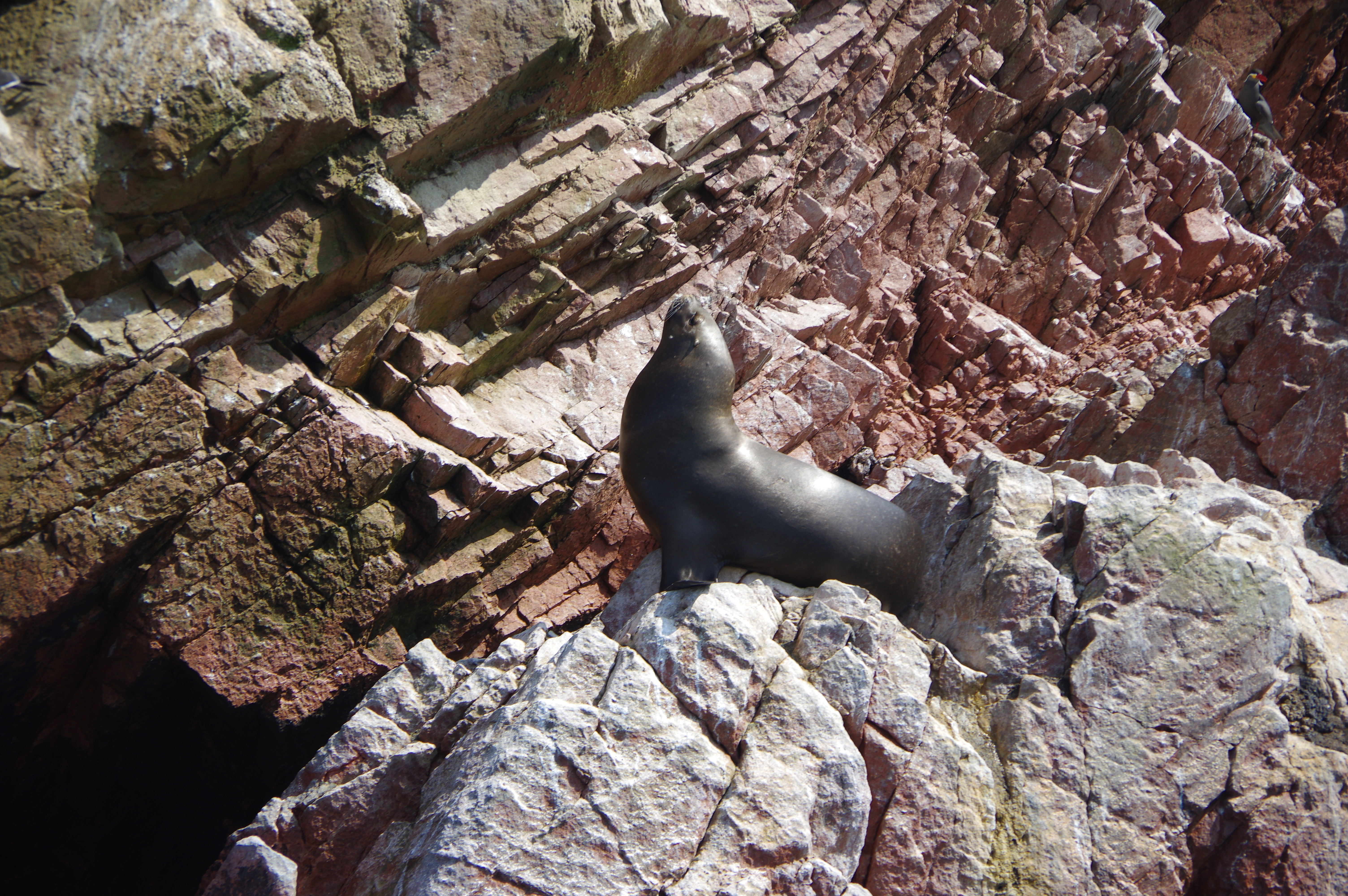
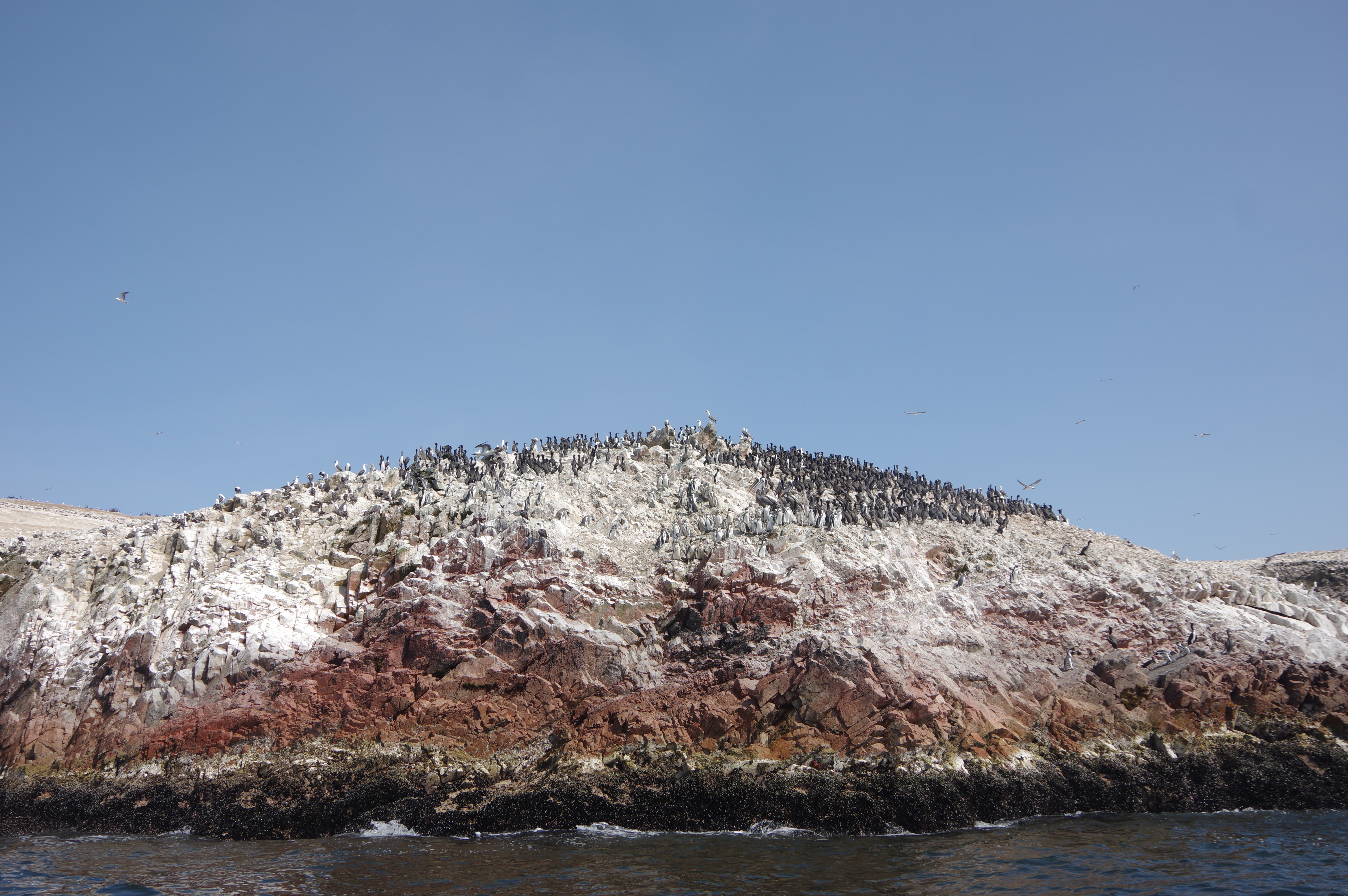
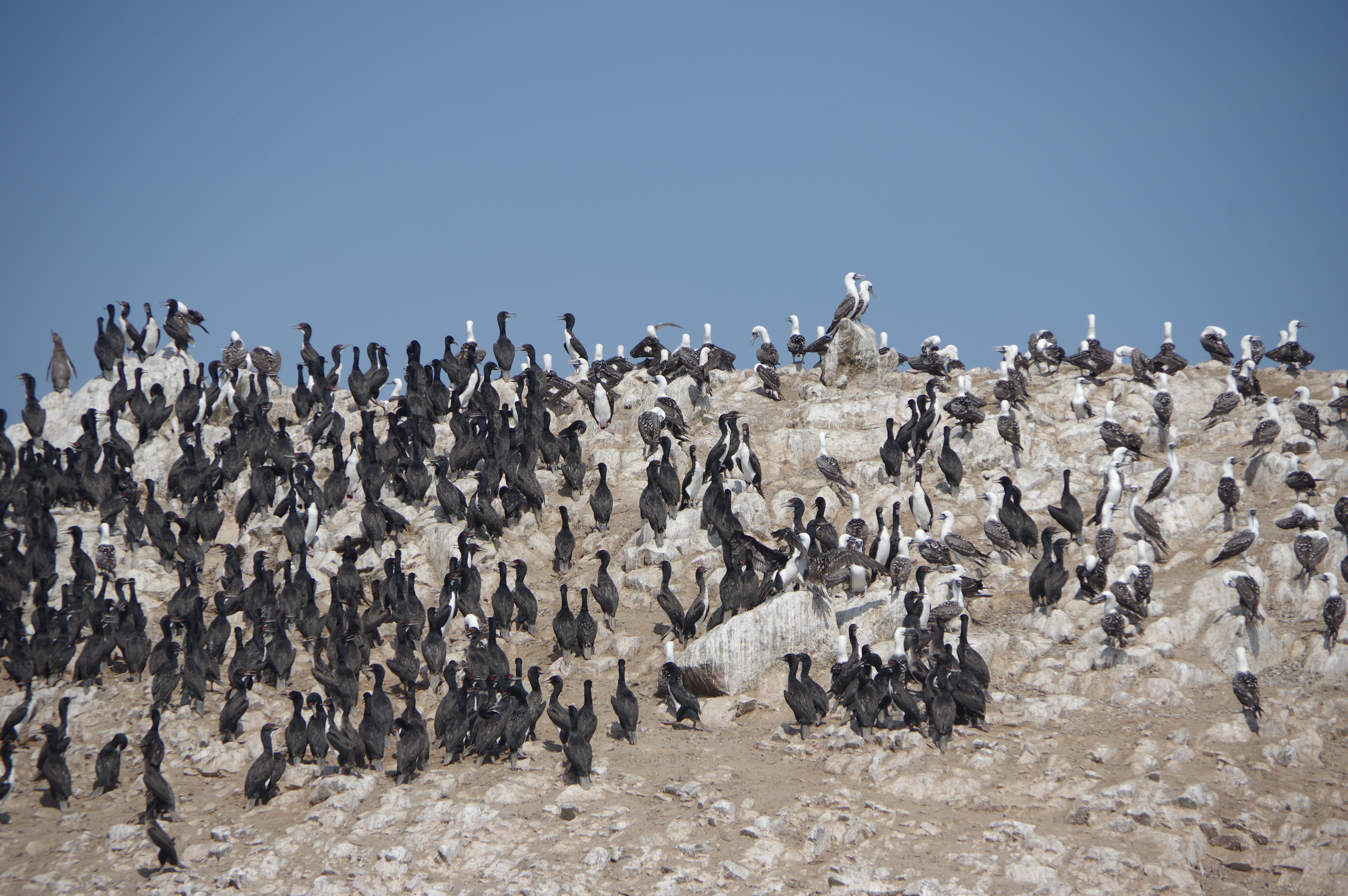
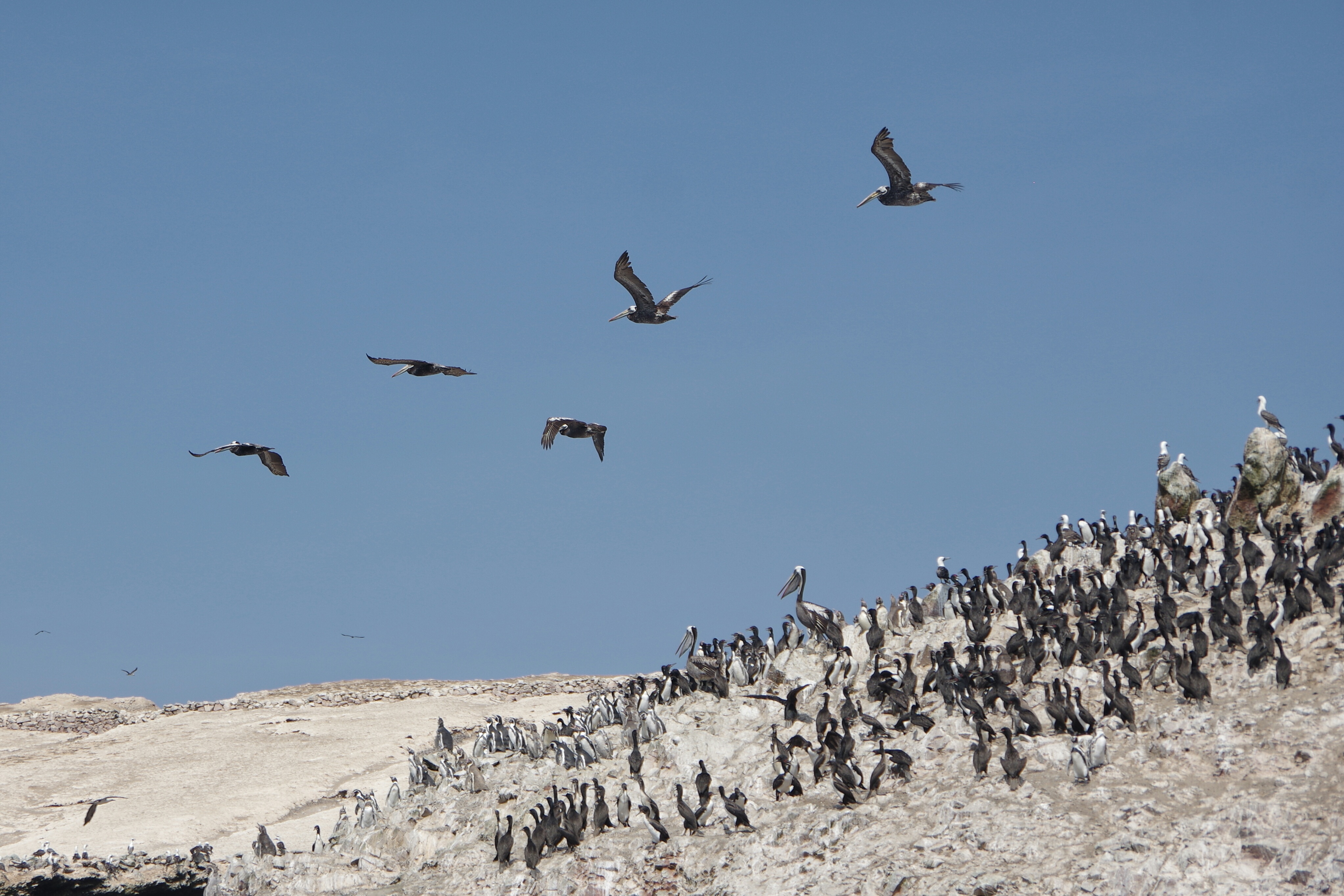
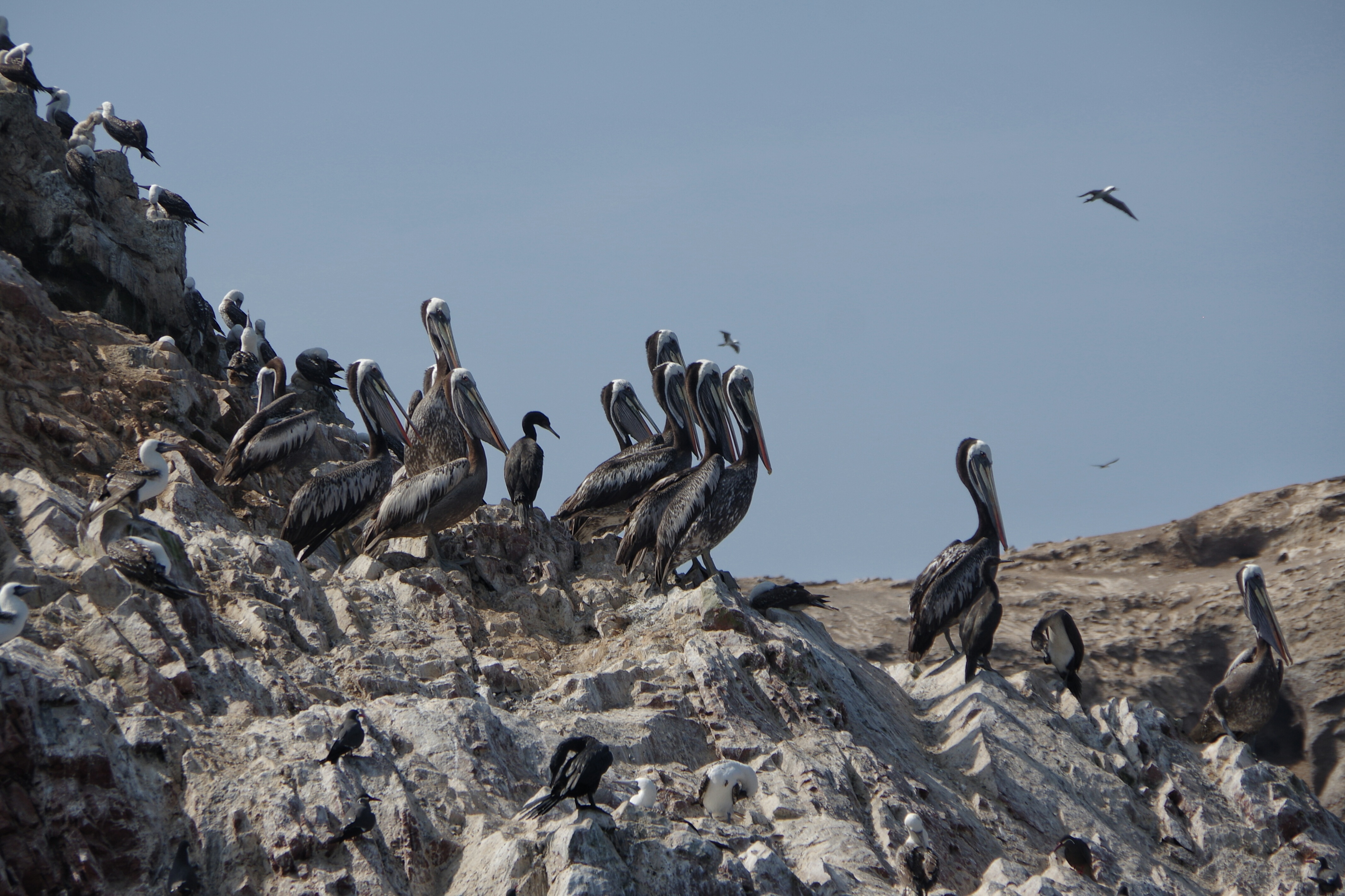
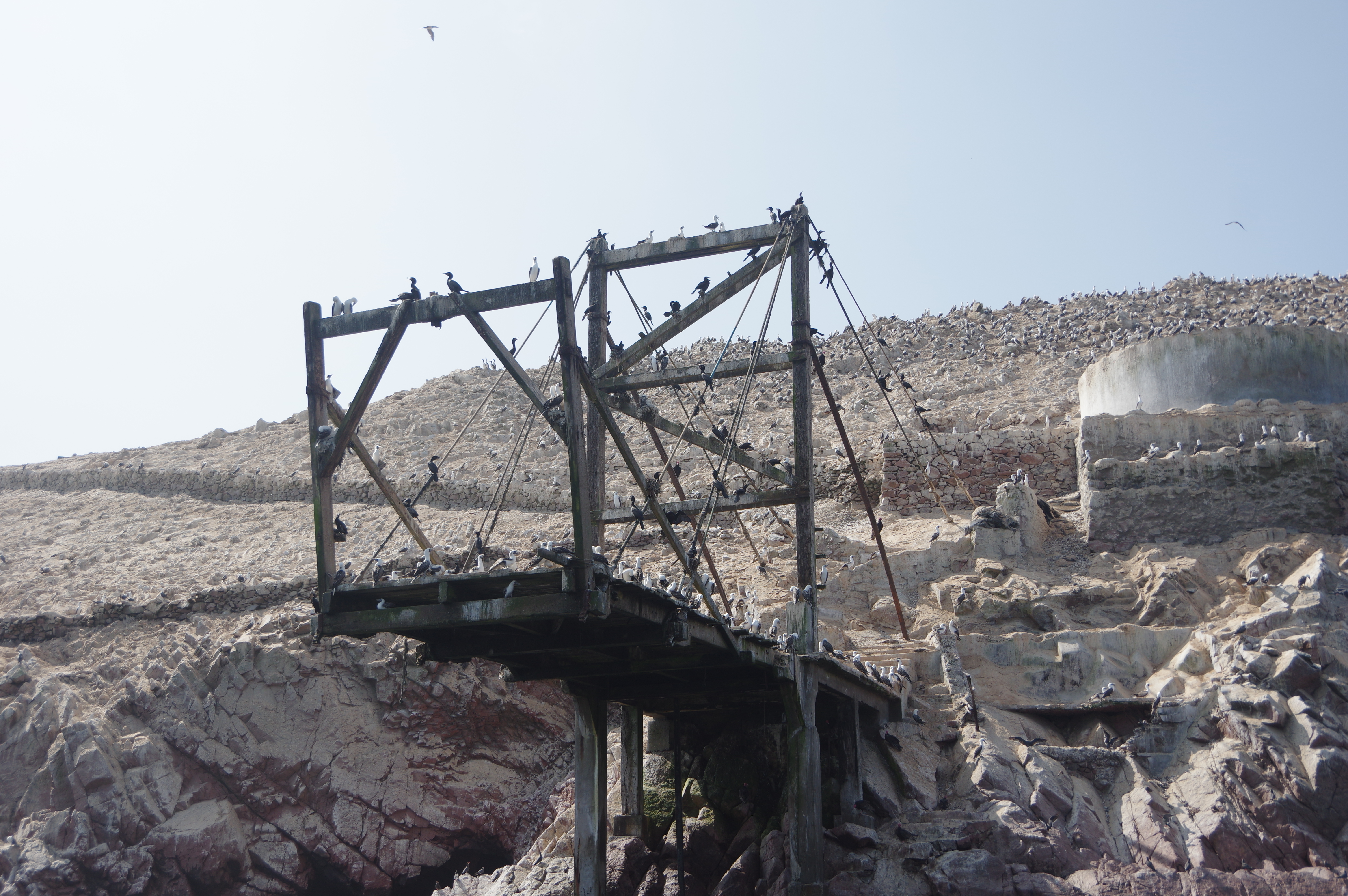
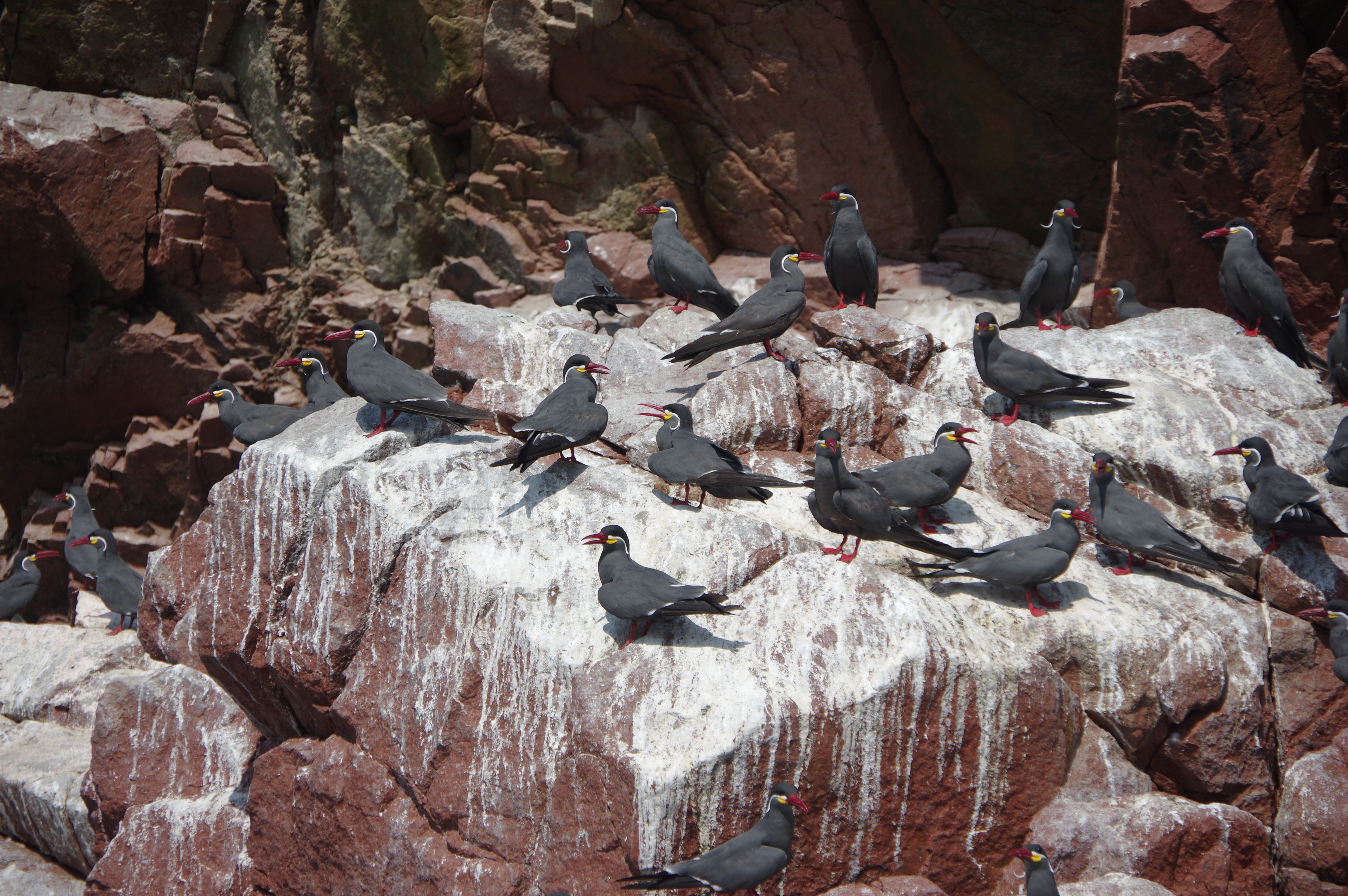
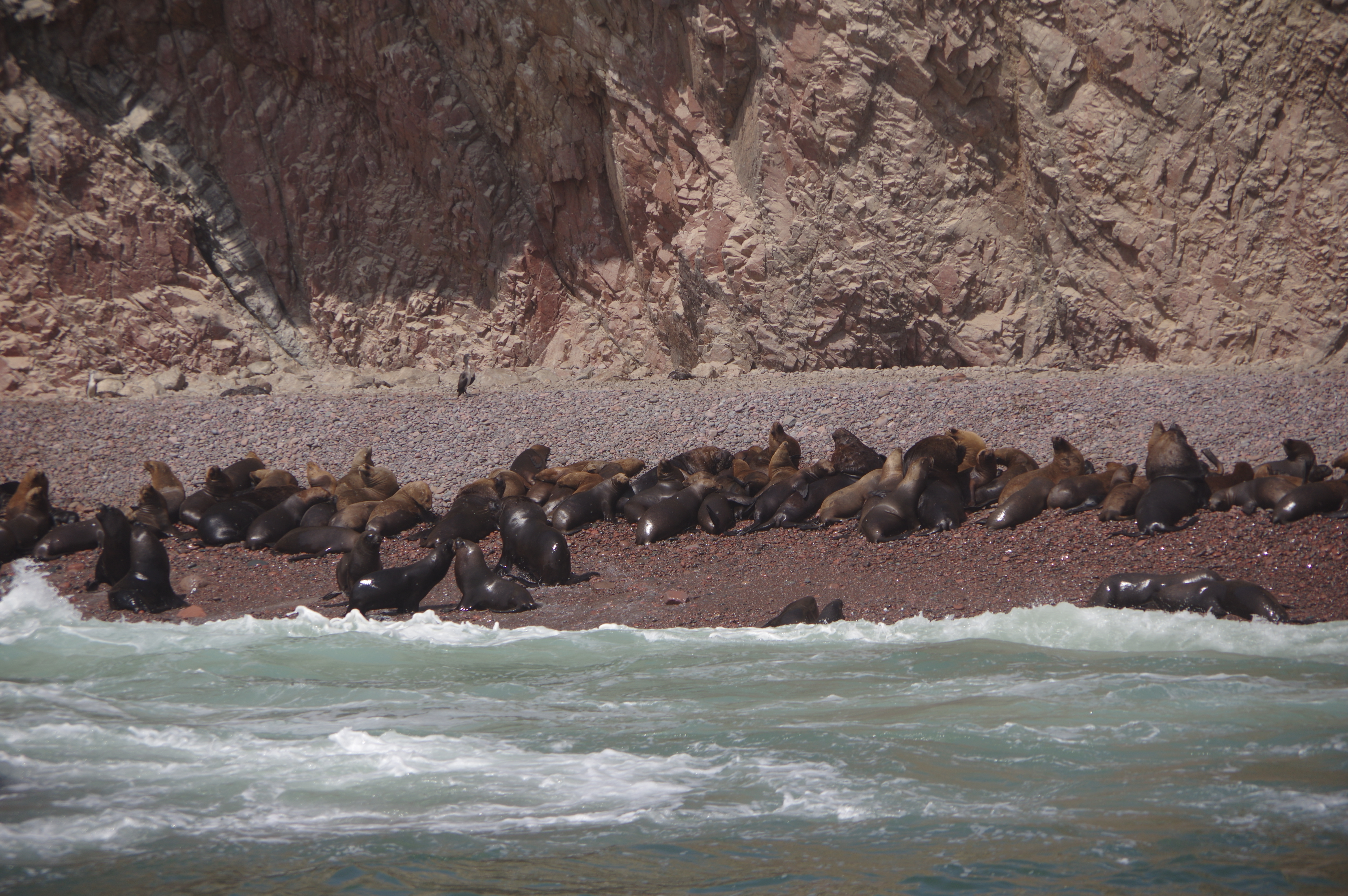
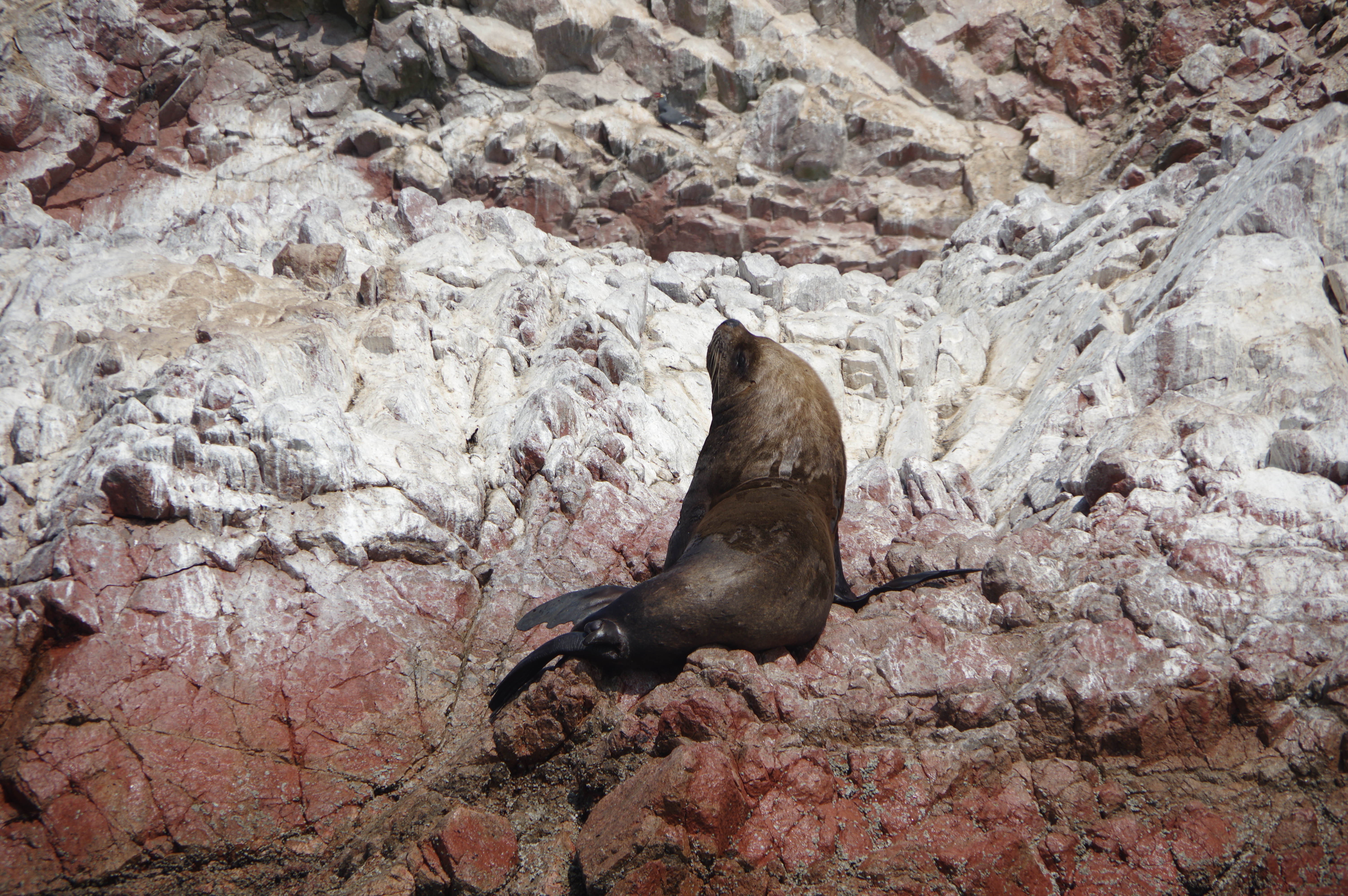
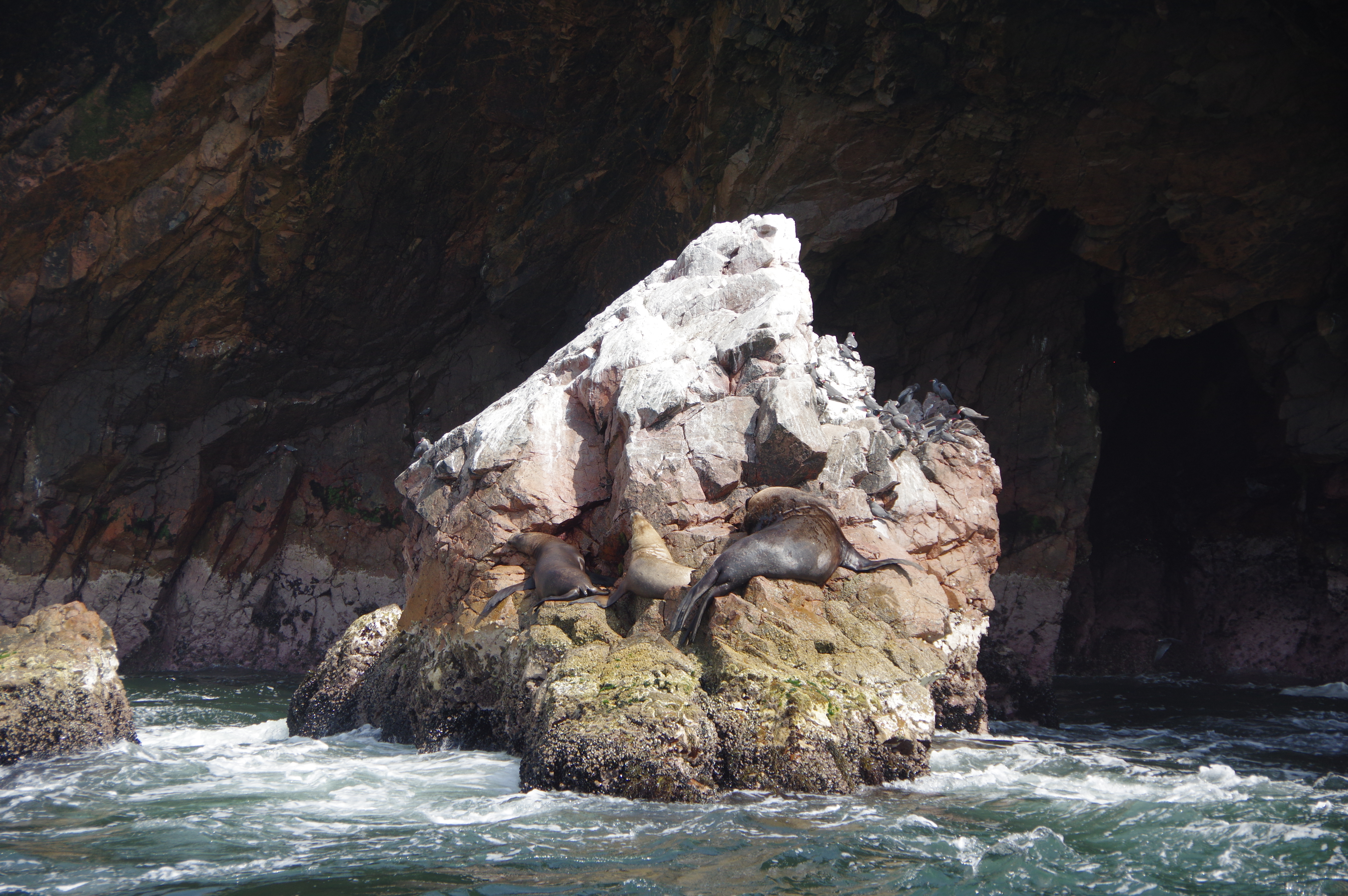
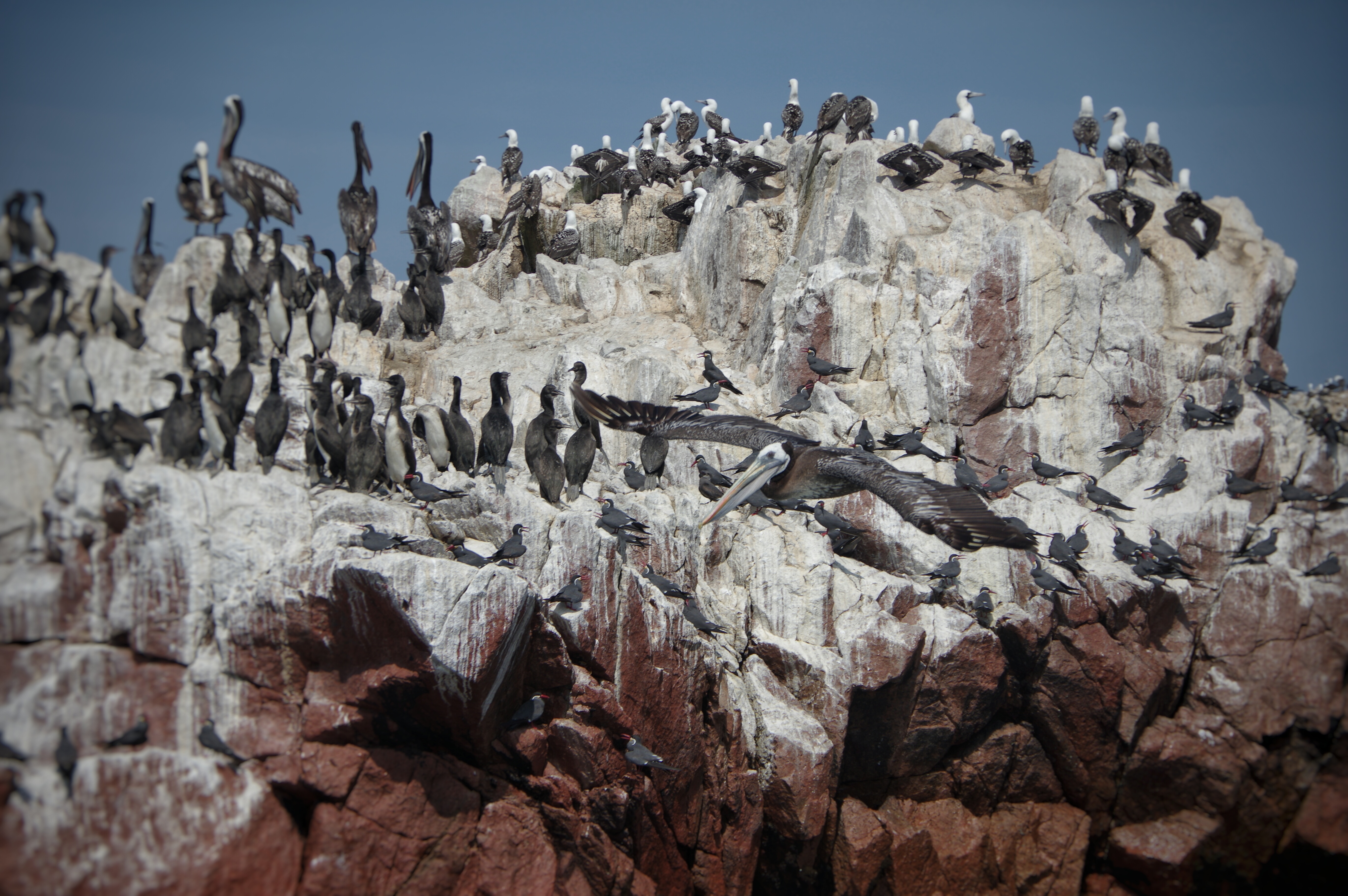
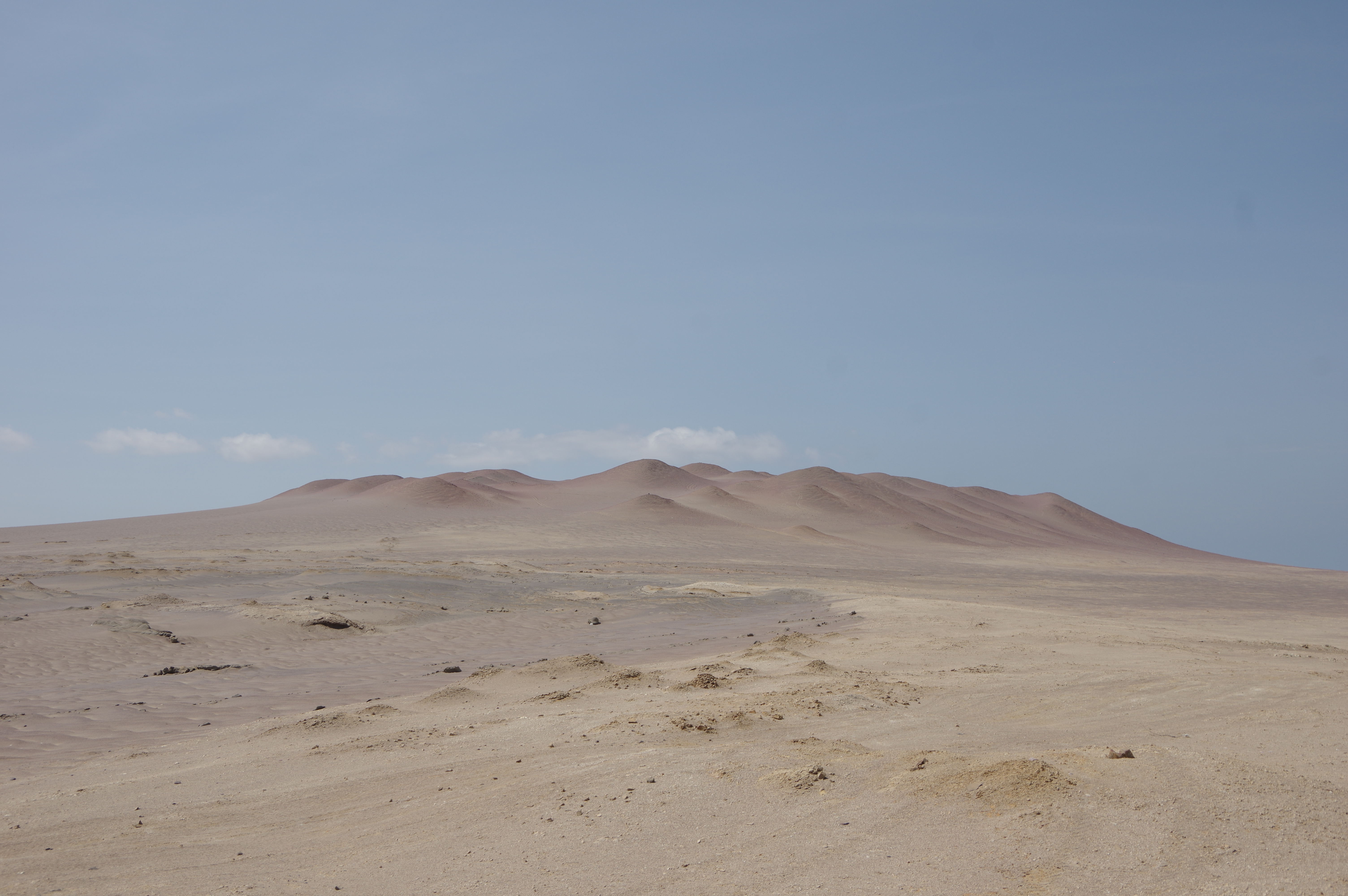
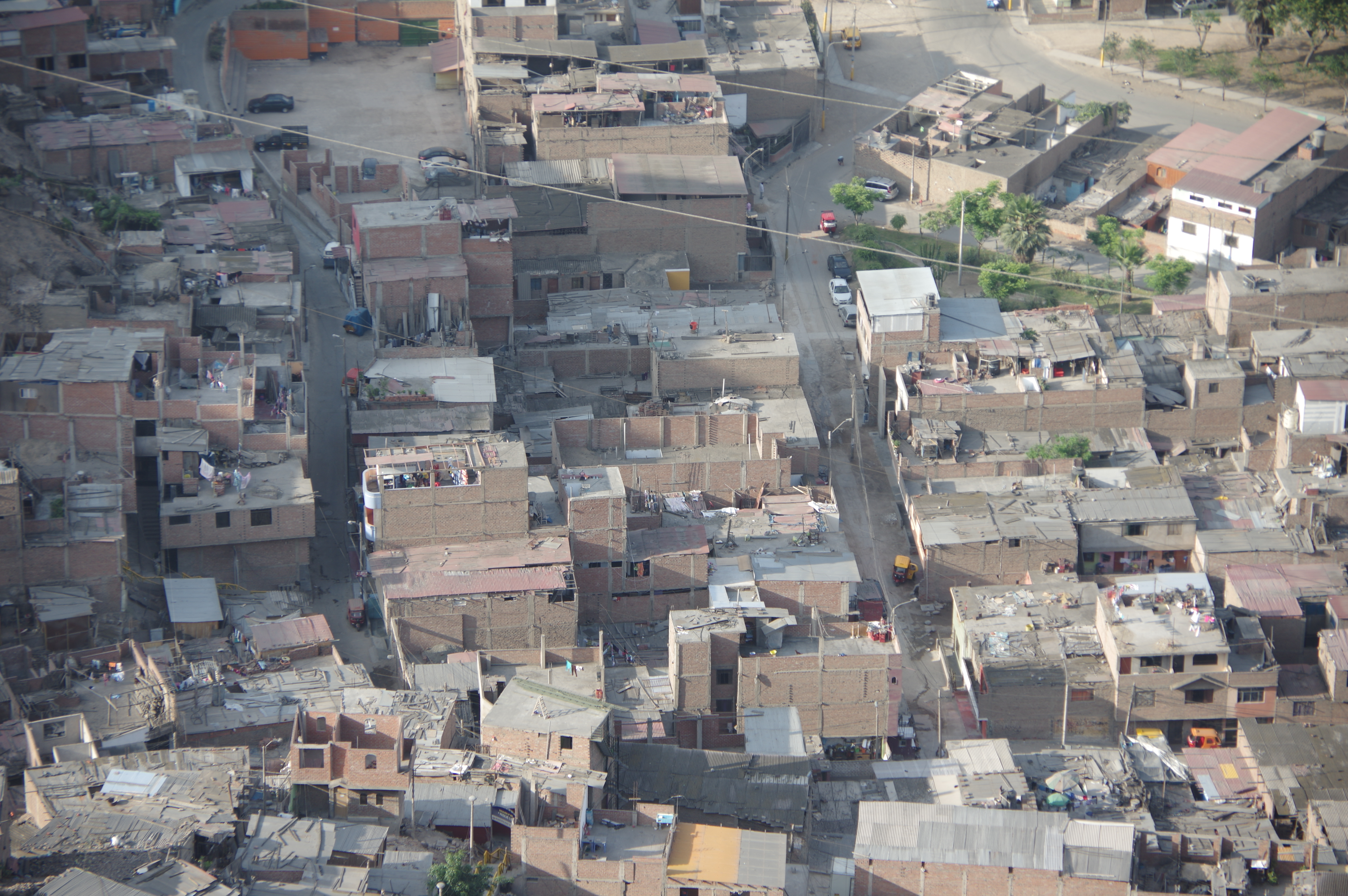
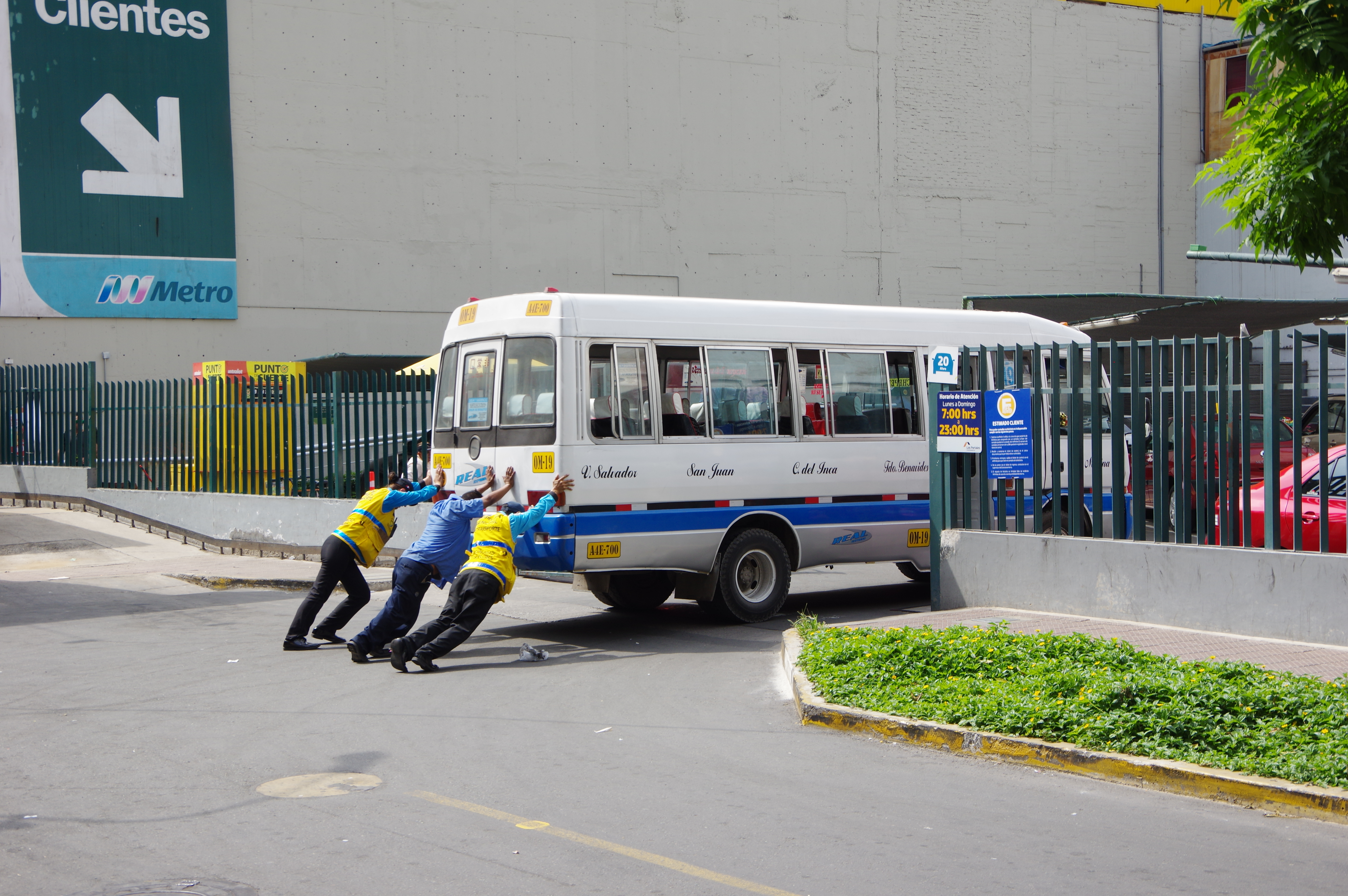
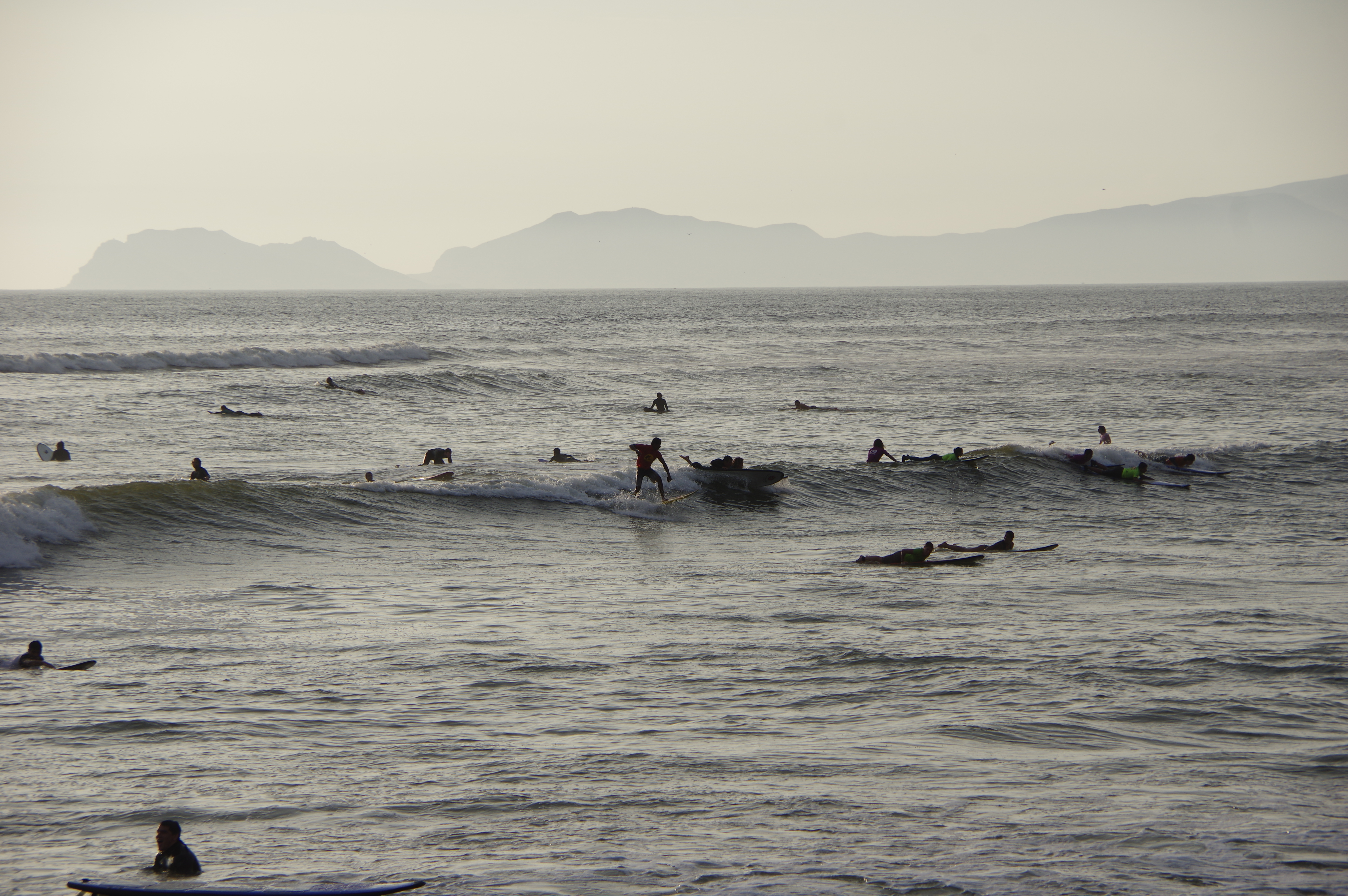
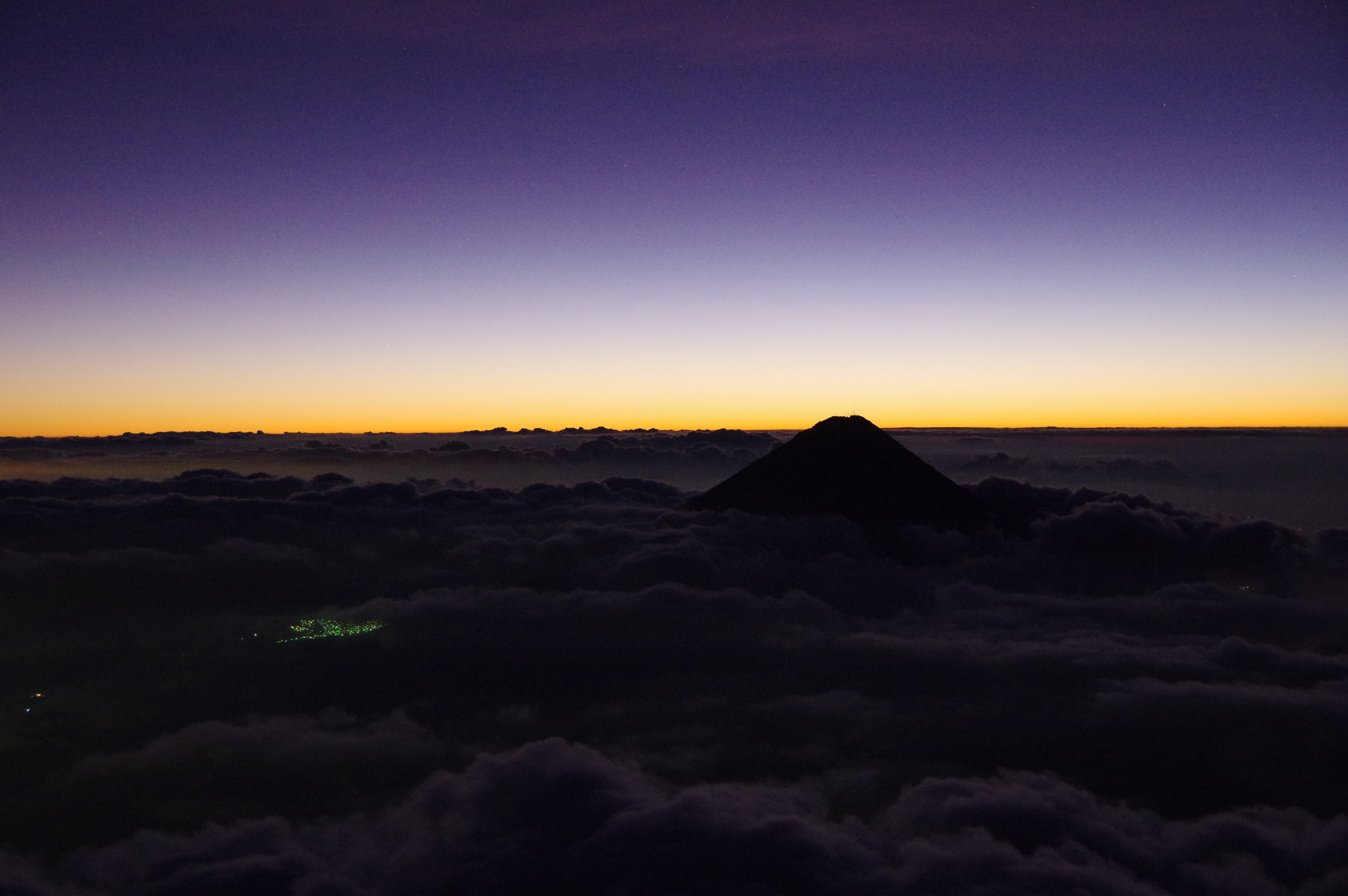
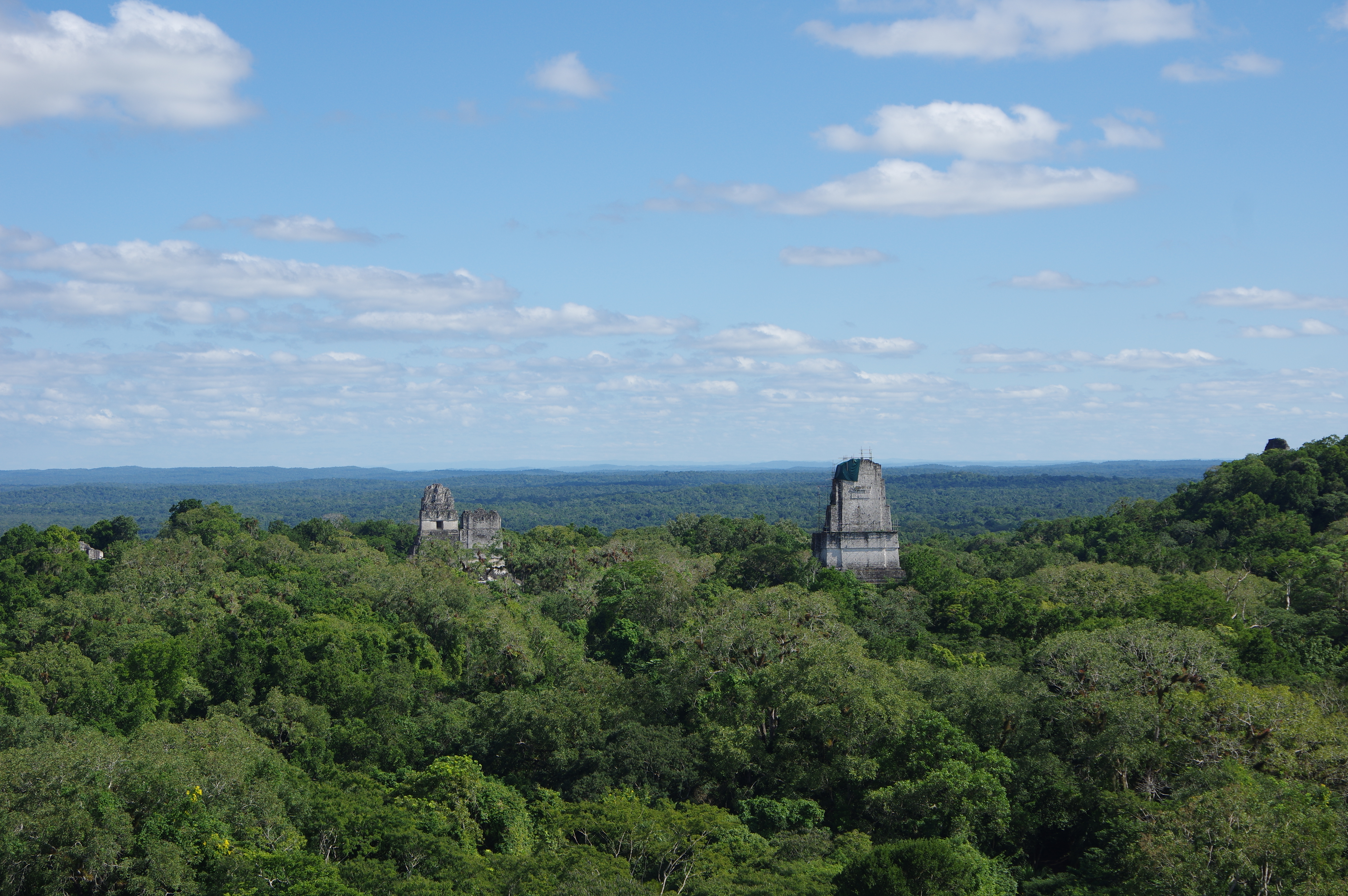
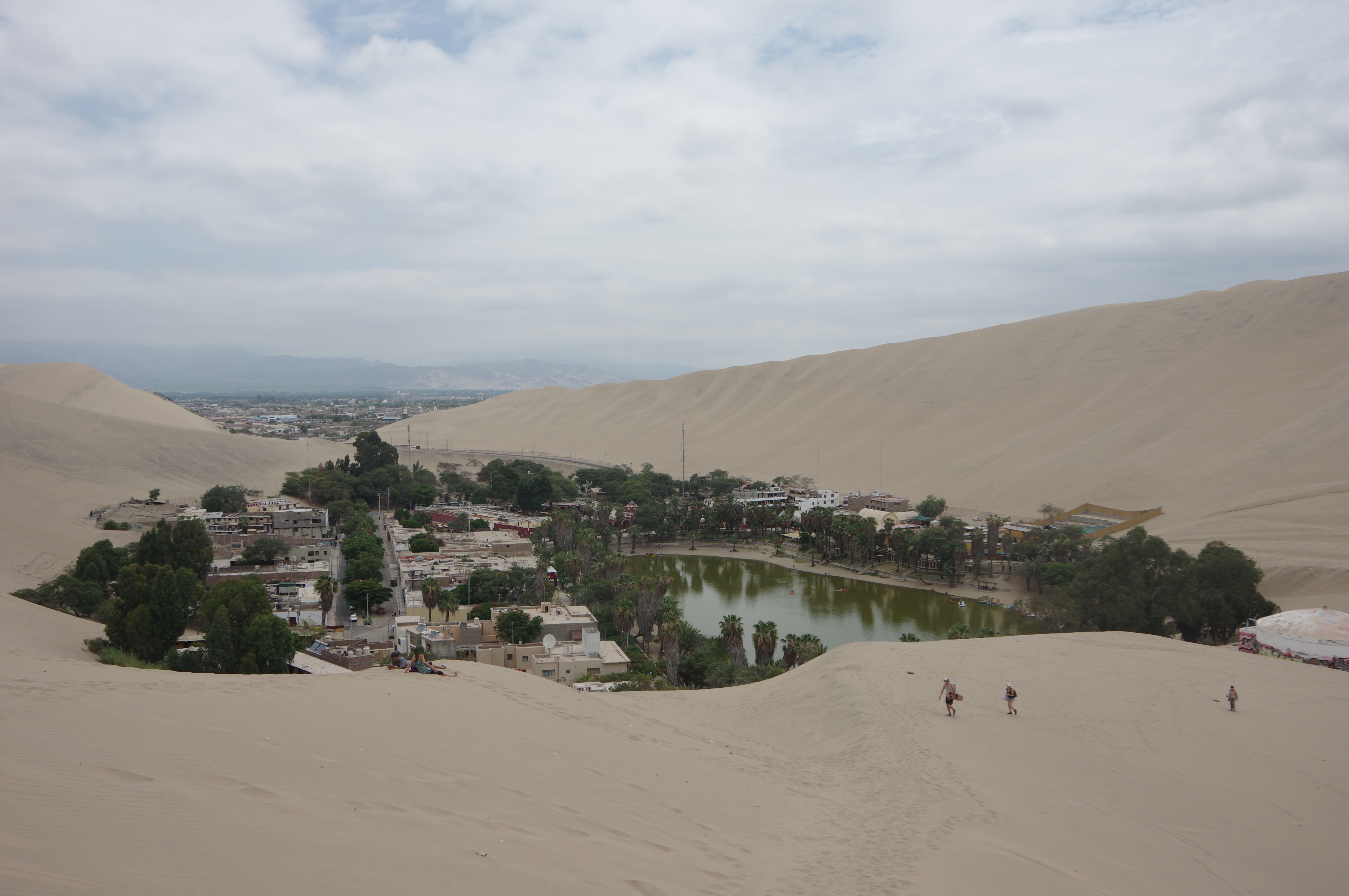
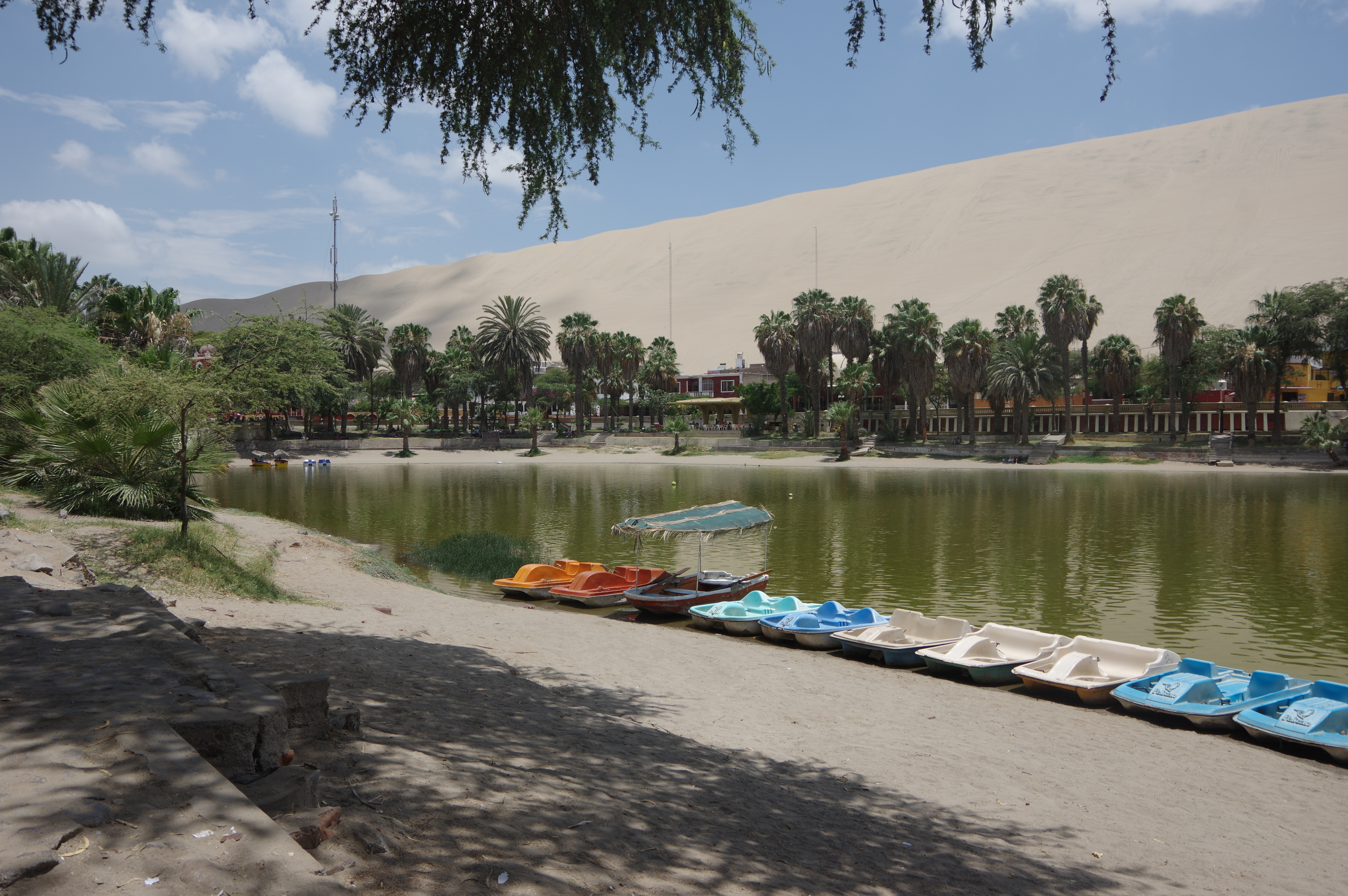
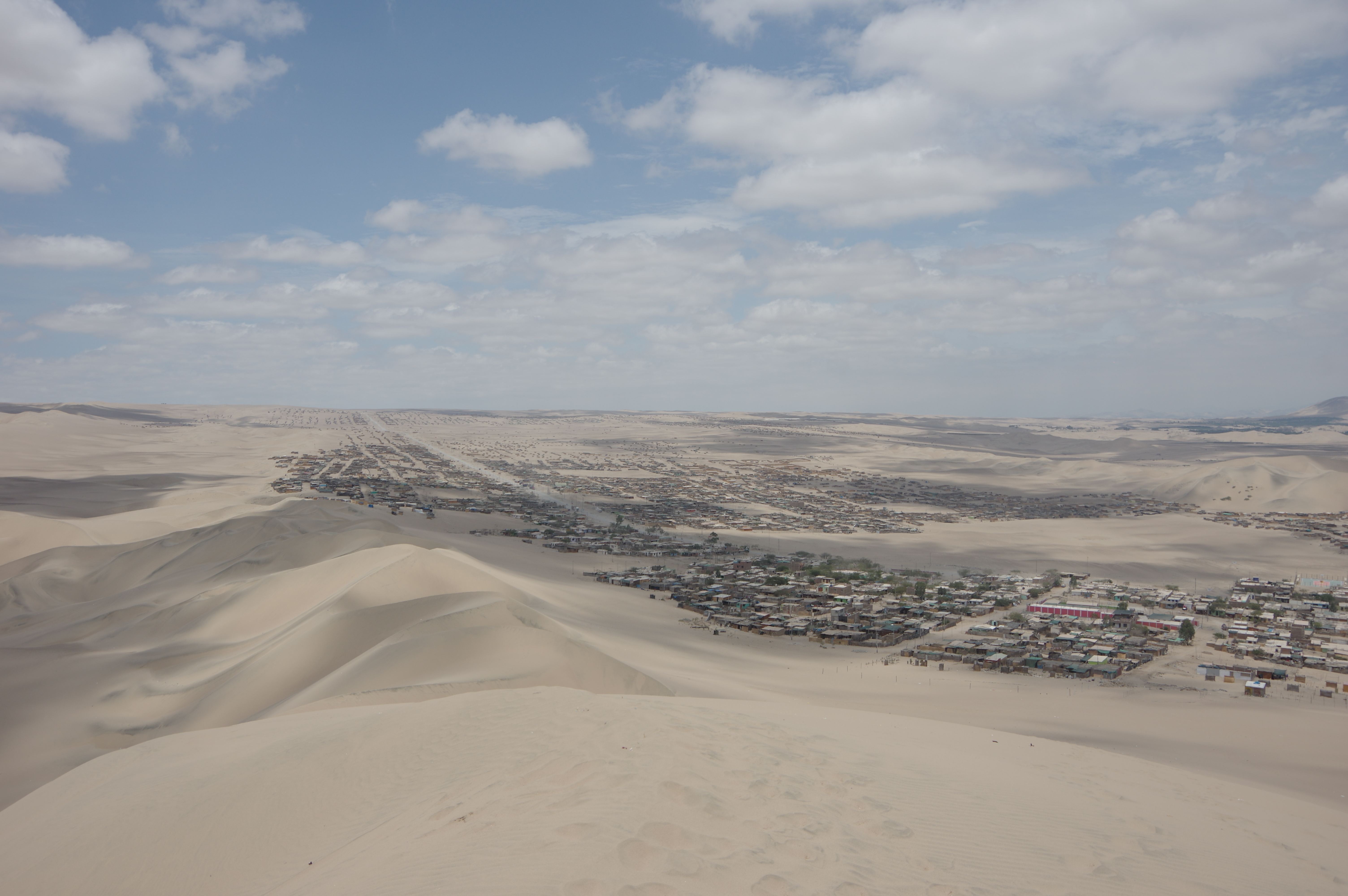
JAN 21, 2016 – Just an hour and a half from Paracas lies Ica, a large city with hardly any tourists. Instead, visitors to the area flock into Huacachina, a desert oasis just five kilometers from downtown Ica. The lagoon in the center of the settlement is artificially fed nowadays, but it still looks picturesque with all the sand dunes around it. I had planned to sleep in my tent, but I arrived after dark and there was no official campsite, so I stayed at a hostel instead.

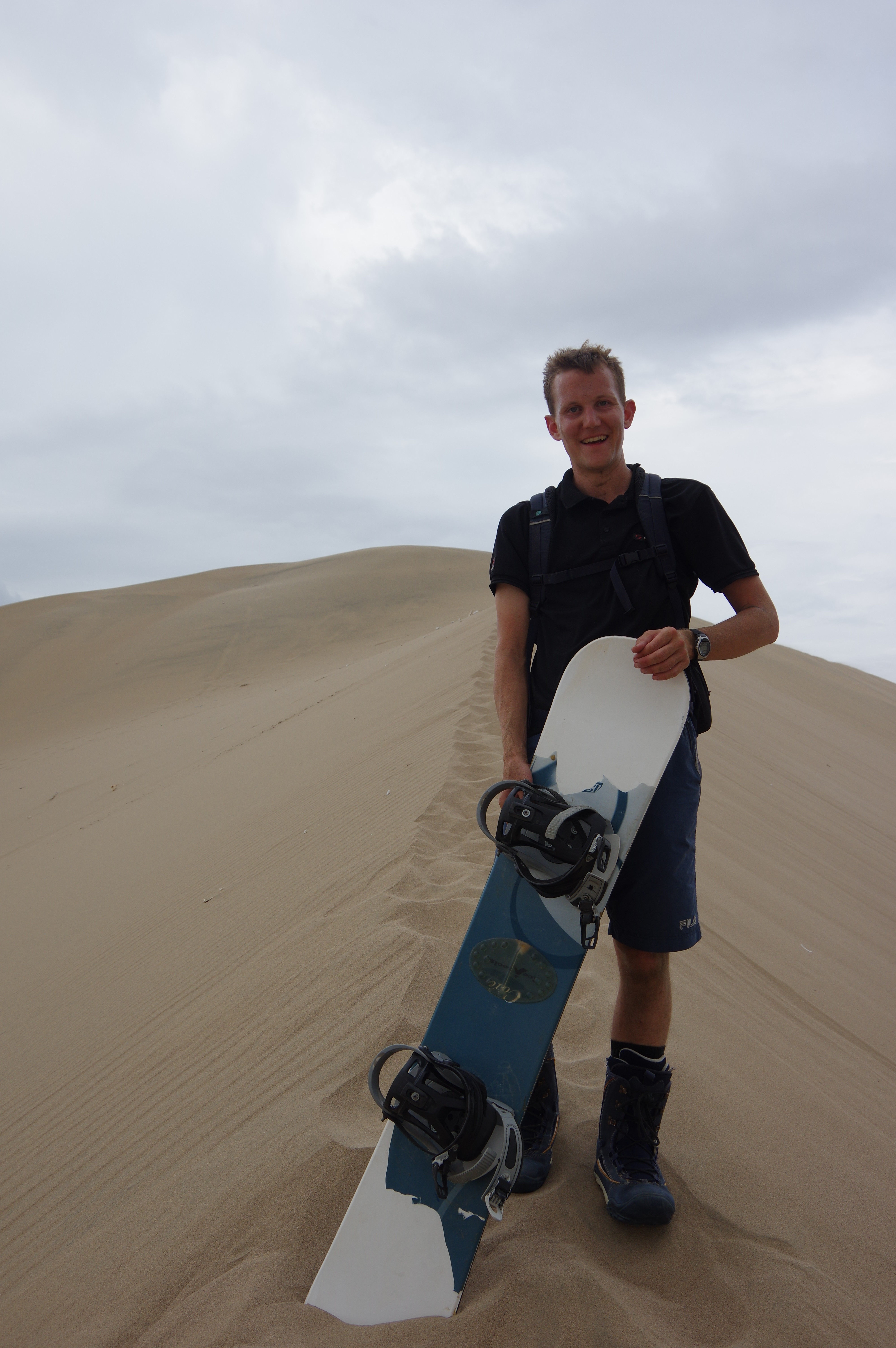
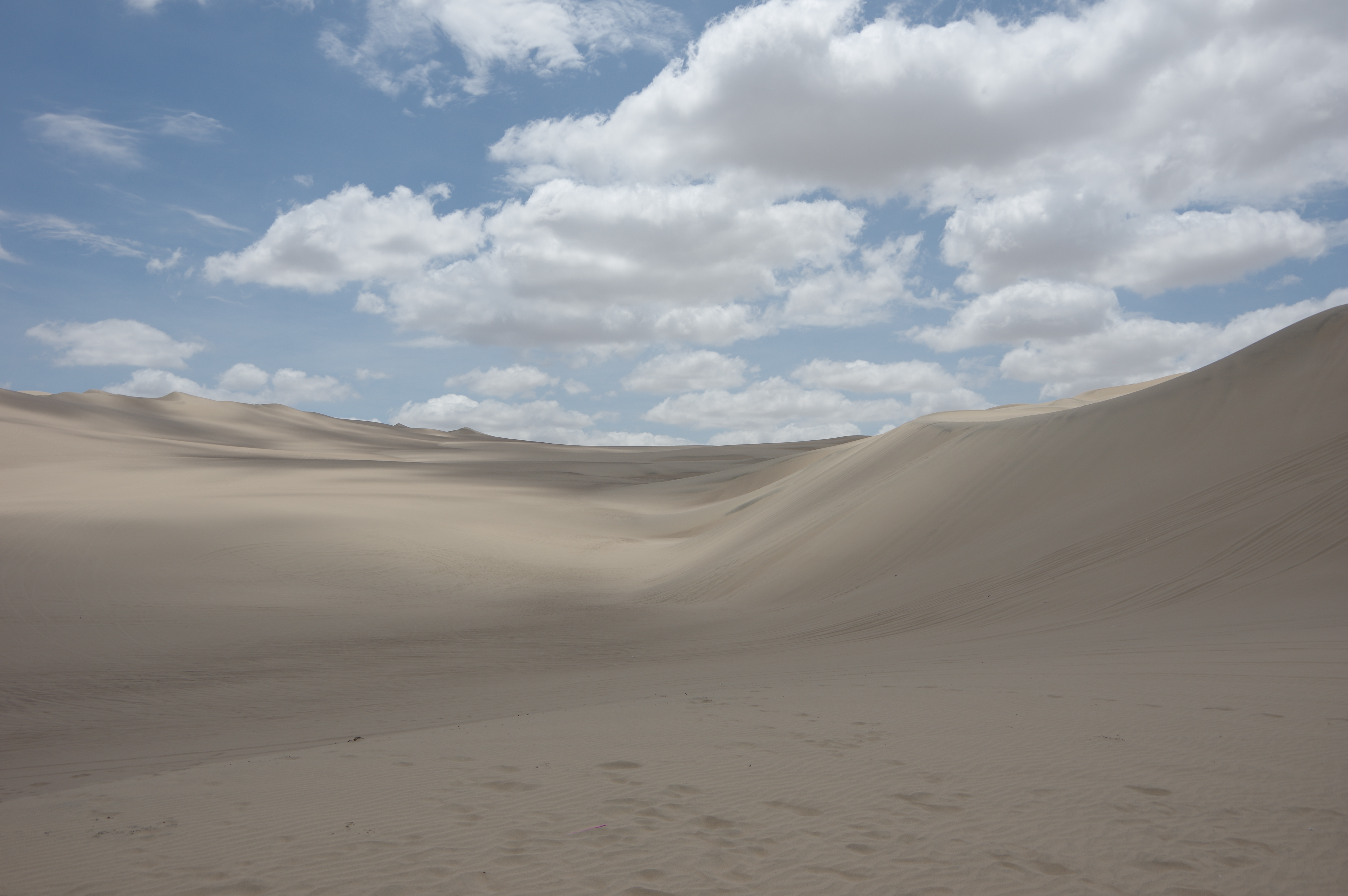
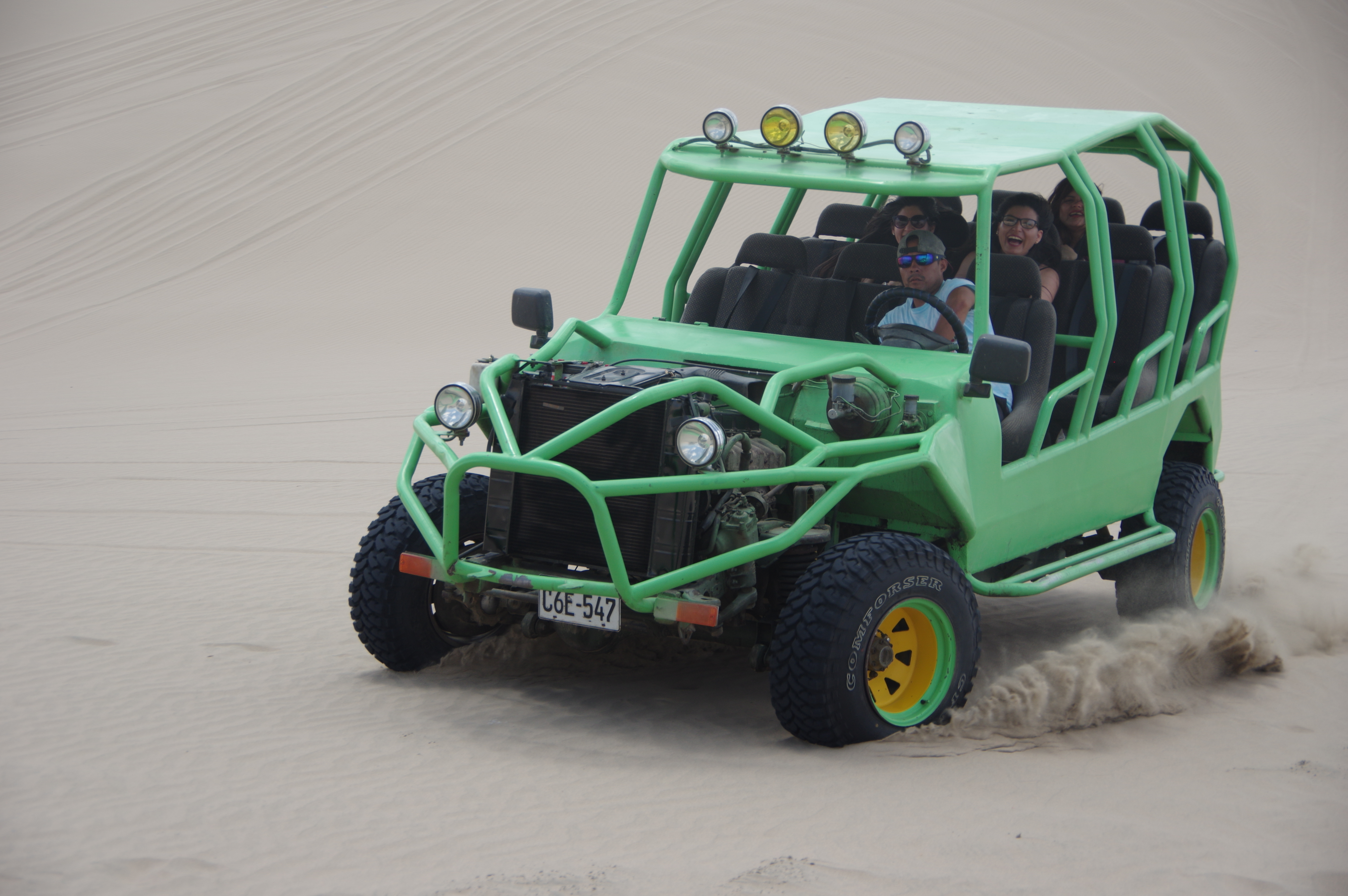
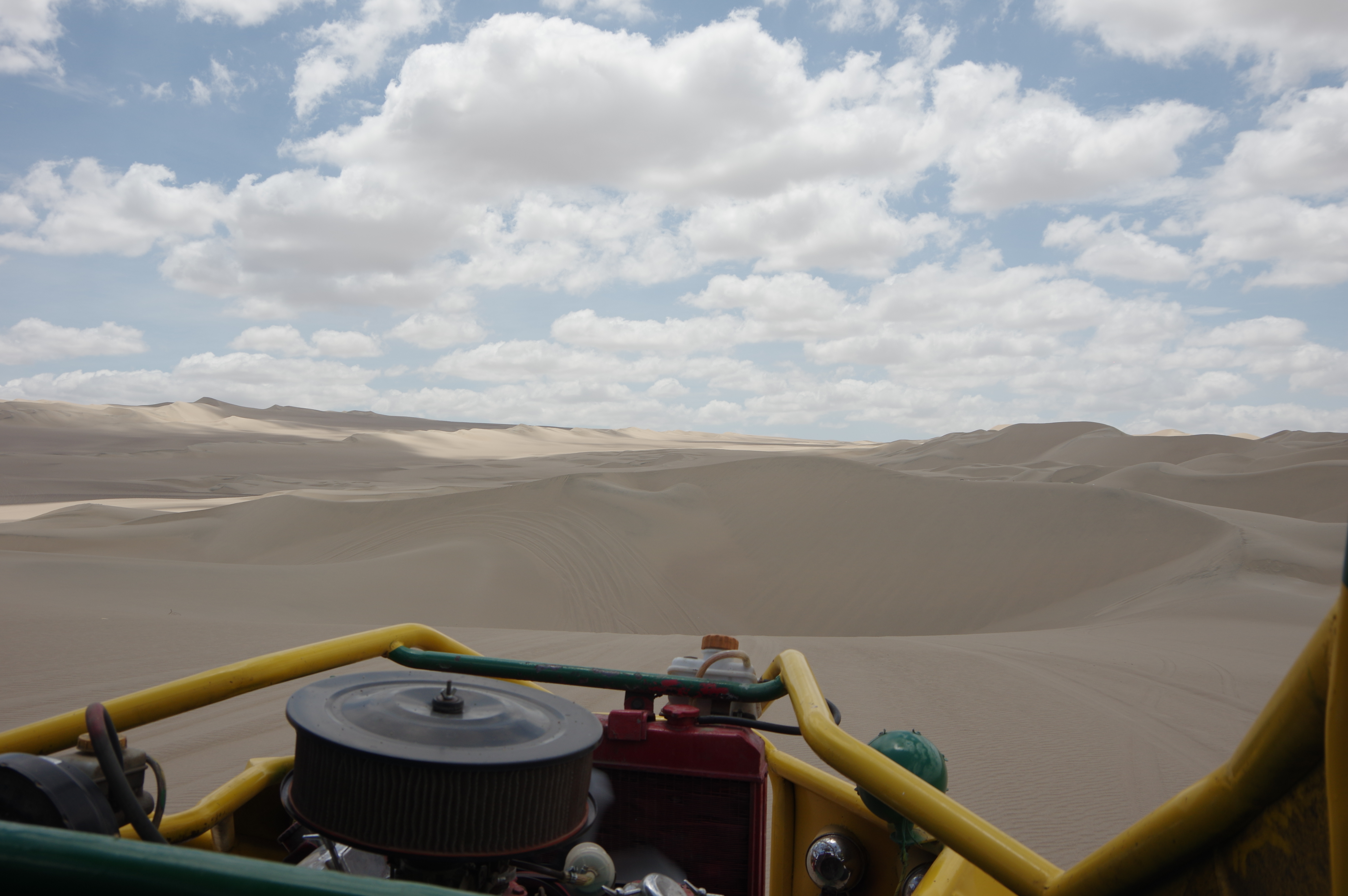
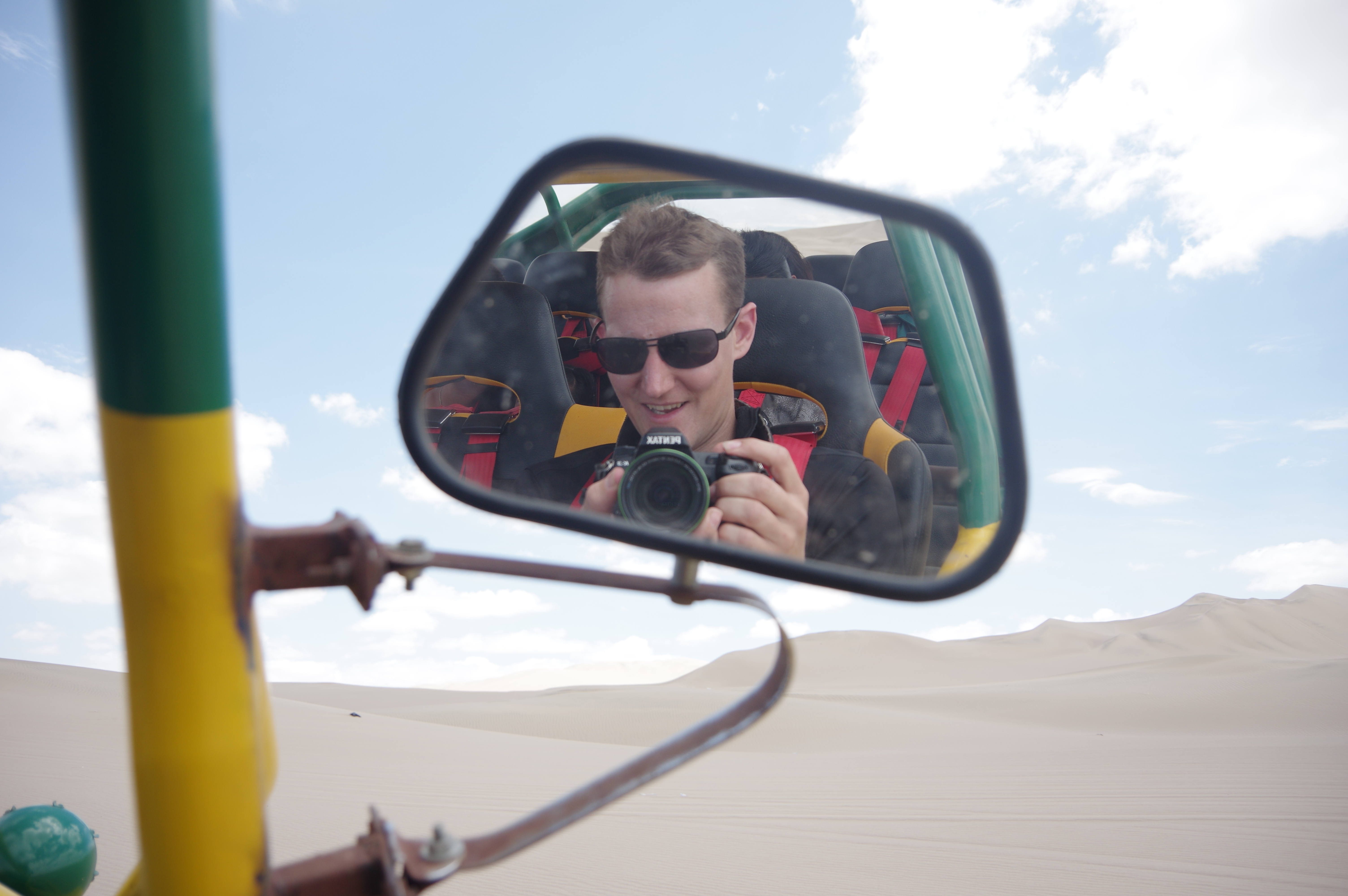
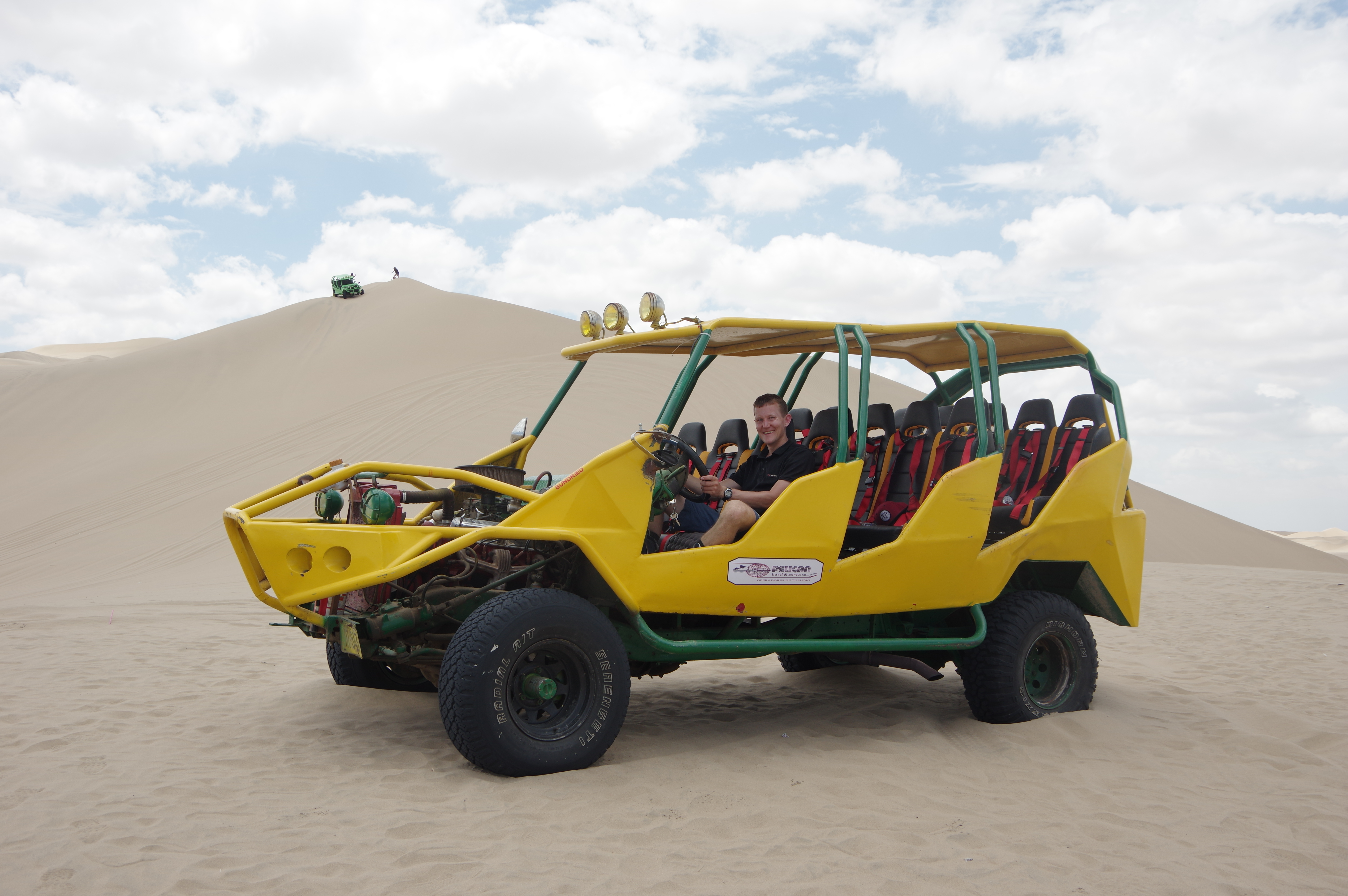
A nearby shop rented out skiing and snowboarding equipment, which apparently originated from the Swiss resort of Verbier. I rented a board and spent the morning trying it out. As one might expect, sandboarding is very similar to snowboarding, you just have to apply wax before every descent and you go a bit slower, similar to heavy deep snow. It’s fun! Unfortunately there were no lifts, so I had to walk uphill every time. In the afternoon I went for a sand buggy tour with a group. This was fun too, as the driver used the dunes to create a riding experience like on a roller coaster. The same night I boarded a bus to Cusco, and it was the longest bus ride of the trip so far: 17 hours.
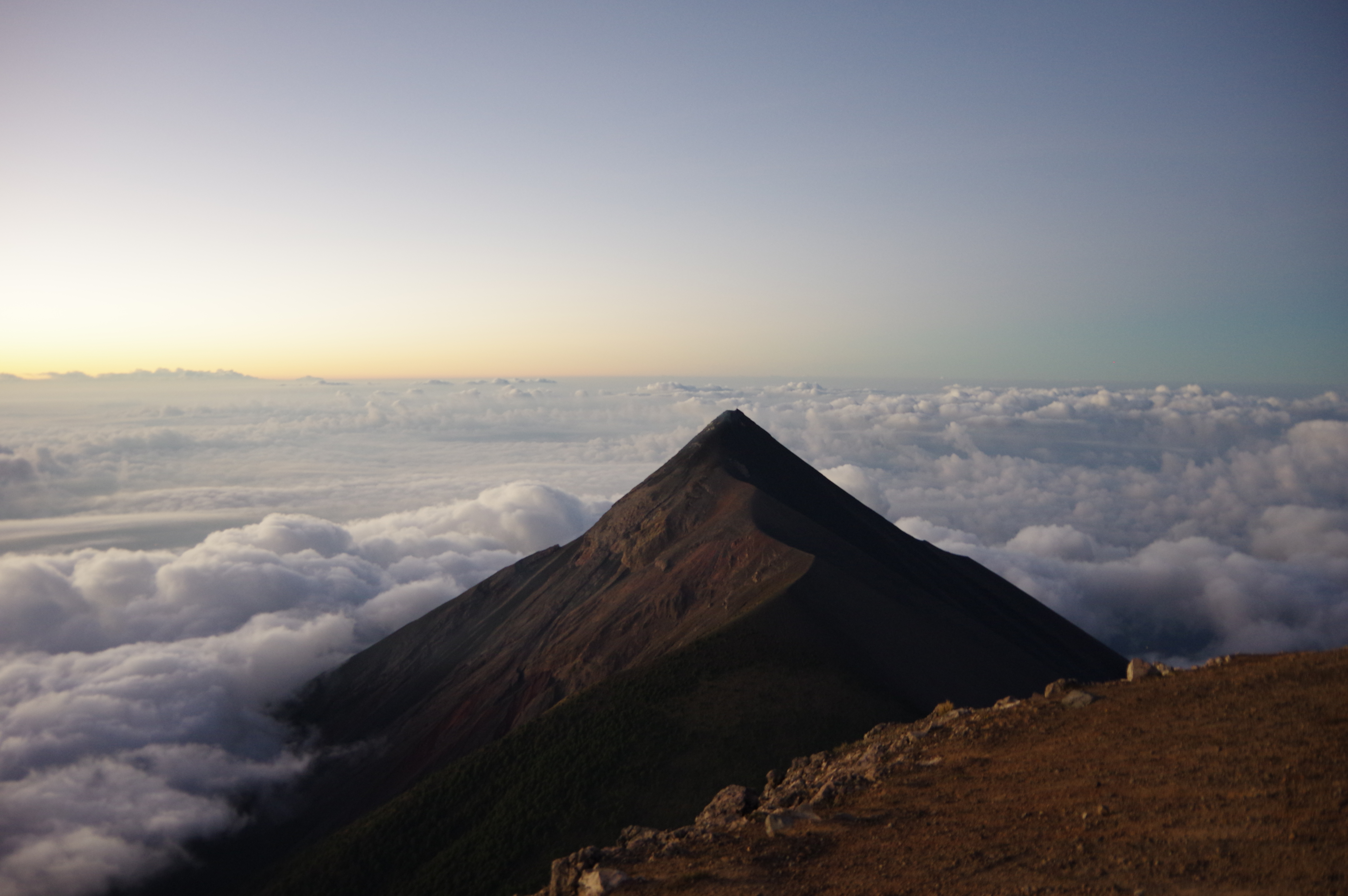
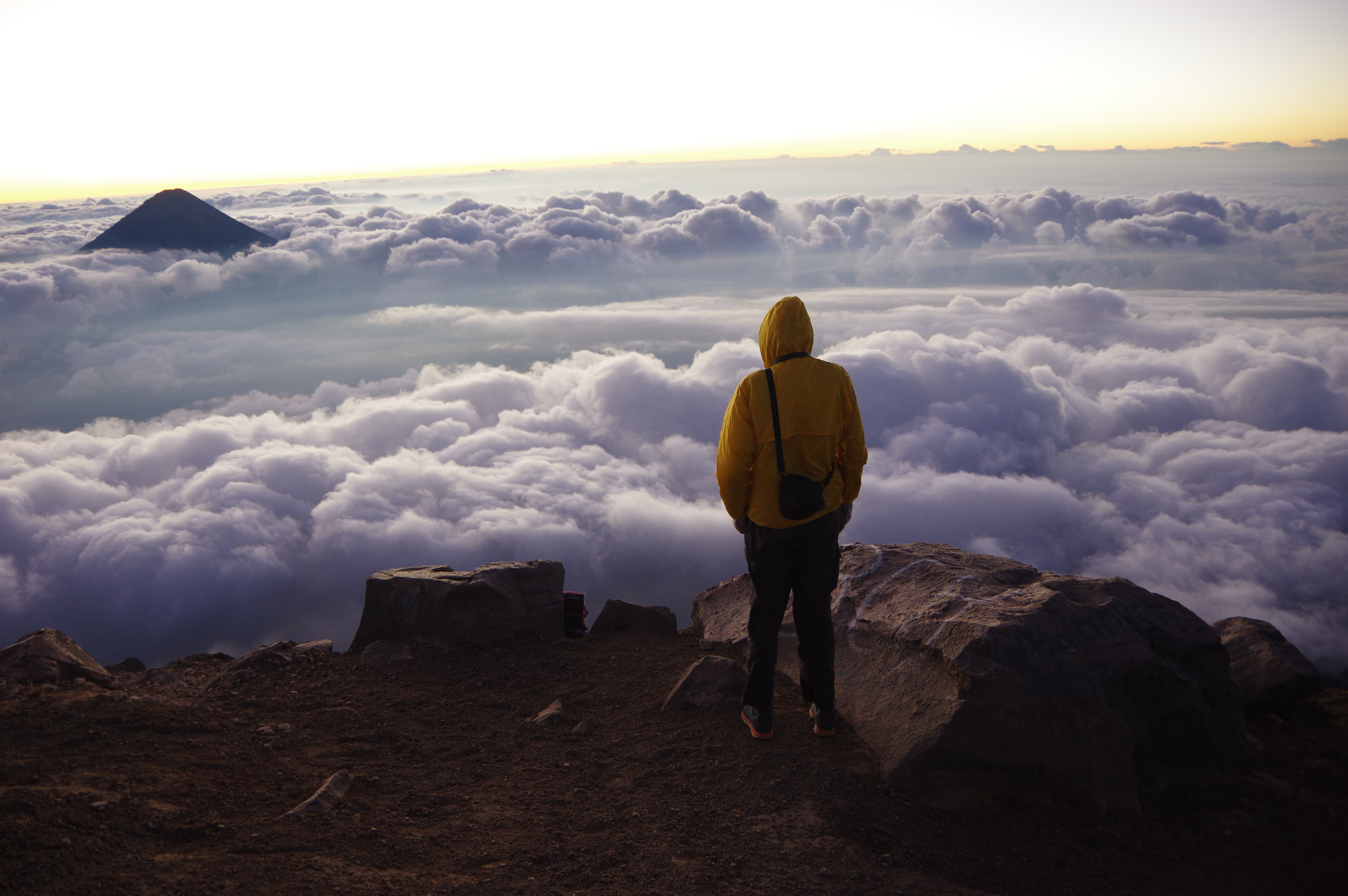
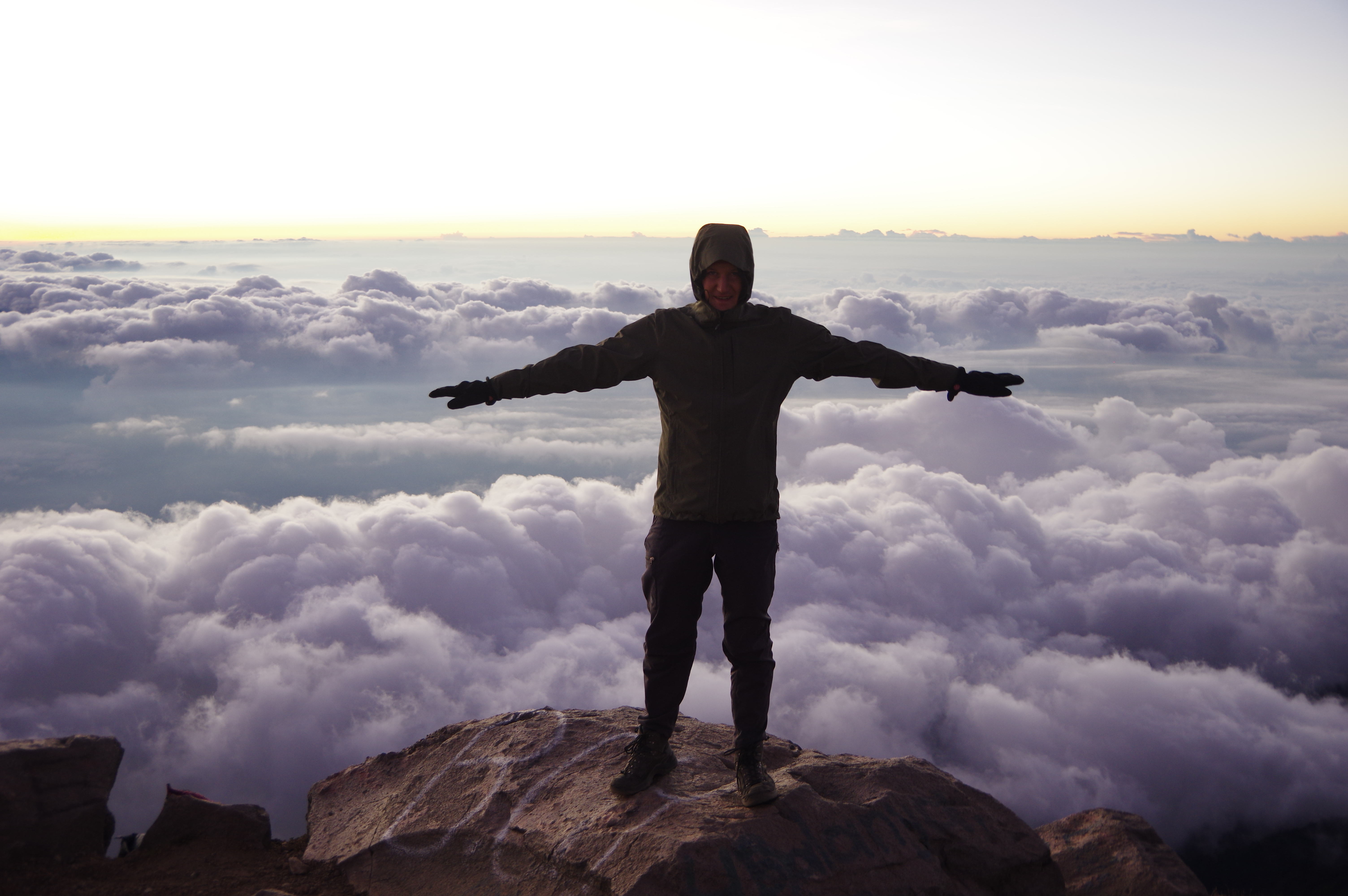
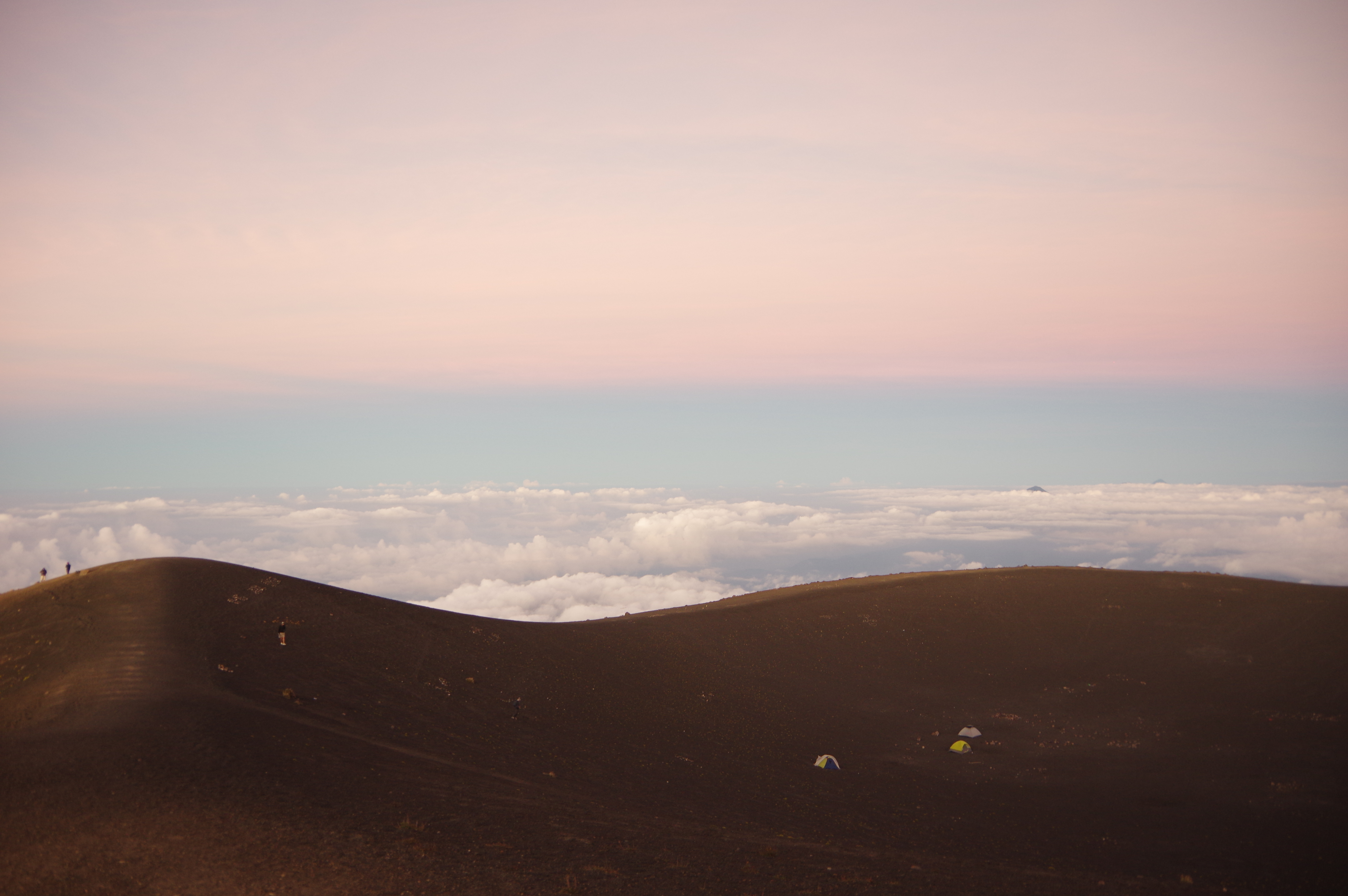
Huacachina oasis
Huacachina oasis

IMGP1042

View from the dunes -  Ica stretches out into the desert!
View from the dunes – Ica stretches out into the desert!

IMGP1073

Braking sand buggy
Braking sand buggy

IMGP1049

IMGP1025

IMGP1061

IMGP1093

IMGP1113 (1)

Ica's busy center
Ica’s busy center – just 5km away…

Paracas and Islas Ballestas – Knee deep in bird droppings

Flying pelican (edited)

JAN 20, 2016 – From Lima I decided to go to Cusco by bus rather than airplane. This allowed me to see two very worthwhile attractions I hadn’t heard of before. The first one was Paracas with its Ballestas islands, nicknamed “poor man’s Galápagos”. The fauna was not half as cool as on the famous Ecuadorian islands, where dragonlike geckos can be found, among many other animals. But the Humboldt penguins, sea lions and thousands of birds were still an attraction. The pelicans were perhaps my favorite creatures there, and their slow take-off made it easy to take pictures of them in flight. Apparently the bird droppings, called Guano, used to be collected and sold as fertilizer. According to our tour guide, this has been discontinued in order to better protect the birds’ habitat.

In the afternoon, I rented a bicycle and rode into the nearby desert reserve with people from my hostel. This trip turned into a little adventure when my chain broke, just as I started riding back to catch my bus. Thanks to friendly locals, I still made it back to Paracas on time, only the owner of the rental bike was not too happy to learn that he would have to pick up his crappy vehicle from the desert. Luckily he had neglected to keep a deposit, so he didn’t have much of a choice.

The Candelabra geoglyph (age and creators unknown)

IMGP0582

These are all birds!
Actually, some are Humboldt penguins
Actually, some are Humboldt penguins (edited)
And then there's sea lions too
And then there’s sea lions too

IMGP0608

IMGP0597

IMGP0621-01

Lots of flying pelicans
Lots of flying pelicans (edited)

IMGP0729-01

IMGP0716-01

IMGP0725

IMGP0737

IMGP0786

IMGP0796

More sea lions
More sea lions

IMGP0896

IMGP0691

... and one last pelican (edited)
… and one last pelican (edited)

IMGP0434

IMGP0979

The nearby desert reserve
There was even an ice cream bike on this beach - in the middle of the desert
There was even an ice cream bike on this beach – in the middle of the desert

IMGP0996-01

My rental bike
My rental bike
Actually the previous night's sunset
Actually the previous night’s sunset

Lima – Colossally colonial and somehow upside down

Fountain on Lima's main square
Fountain on Lima’s main square

JAN 19, 2016 – I had booked a hostel in Miraflores, which is where most hostels (and tourists) are. It’s a good thing taxis are not too expensive in Peru, because Lima’s airport completely lacks any public transportation. There are van lines passing near it, but their use is apparently discouraged for safety reasons. Once arrived, I explored the city on foot, by bike, and by bus. Its structure is interesting: The historical center is a cheap area nowadays, and mostly locals live around it. The hillsides around the city, where one might expect penthouse districts, are poor neighborhoods. Most of the rich people live on the coast instead, in the Miraflores and Barranco districts. From the top of Cerro San Cristobal, where a van took me for less than two dollars, it became apparent just how small the “developed” part of the city is: Most of Lima consists of raw brick buildings, interspersed with simple huts. Apparently there is a tax incentive for never finishing to build your house, but I still think the city is poorer on average than any European capital, or than Mexico City for example. I wouldn’t make that statement for Peru as a whole, since countries like Bulgaria or Romania are much poorer in rural areas than in the big cities, which doesn’t seem to be the case in Peru. But that’s just my personal impression from the little I’ve seen of all these places.
The downtown area is full of colonial buildings, most of which were rebuilt several times due to earthquakes. In Miraflores, some ruins from the pre-incan Lima culture have only recently been found and excavated under a former landfill. The impressive pyramid, called Huaca Pucllana, is built entirely of adobe bricks, which allowed it to survive all the earthquakes.

The old Post Office building (1924)
Archbishop's Palace and cathedral
Archbishop’s Palace and cathedral
Inside the Archbishop's Palace
Inside the palace
Chapel of the palace
Cerro San Cristóbal
Cerro San Cristóbal
Cross on Cerro San Cristóbal
Cross on the summit
Choose the color of your candle carefully
View of the "Tren eléctrico"
View of the “Tren eléctrico”

IMGP0412

This is what most of Lima's houses look like
This is what most of Lima’s houses look like
In a park in Miraflores
Nice bike lane along a boulevard

IMGP0252

Crappy-looking local buses are common even in rich neighborhoods

IMGP0260

Miraflores coast
Miraflores coast
Highway along the beach

IMGP0302

IMGP0316

Surfers trying to master the rough sea
Real-life Minecraft at Huaca Pucllana

IMGP0294

IMGP0272

An abandoned Casino
An abandoned Casino

IMGP0243

IMGP0257

IMGP0432

San Pedro – Sleepy coffee farming village and buzzing party town, in one

Coffee berries
Coffee berries

JAN 15, 2016 – After all the language lessons and hikes, I only had two nights left to spend in San Pedro, at lake Atitlán. My original plan had been to stay there longer, perhaps in several villages around the lake, but then I made the Spanish lessons a priority. During my day in San Pedro, I first hiked to the volcano with the same name – this one was safe to do as a solo hike – and then visited the coffee plantations and a local processing plant with a guide I had met on the summit. In town, I drank the best espresso I’d had in a long time, made from organic beans grown on the slopes of the volcano. Sadly, though, many people in Guatemala drink imported instant coffee. San Pedro is a weird place: It has a main street full of tourists, with restaurants, hotels, an American-owned party hostel and one or two clubs, but just a few meters up the hill, its inhabitants go about their daily business, largely undisturbed by the gringos. The cheap accommodation prices attract hippies and long-term travellers, but they don’t seem to blend with the locals much.
From San Pedro, I took a van directly to the airport of Guatemala City. I skipped the capital entirely in favor of volcanoes and language lessons. I don’t know what I missed, but generally I’m not a big fan of large cities without a functional rapid transit system, so it was an easy decision.

Beginning of an early-morning hike
Coffee plants along the way
The raw beans in each berry are covered in a somewhat sweet juice

IMGP0107

One of the nicest views I got (not from the summit though)

IMGP0117

IMGP0118

IMGP0127

A truly amazing "hand flower"
A truly amazing “hand flower”

IMGP0149

Coffee plantations near San Pedro
My guide, also a part-time coffee farmer

IMGP0201

IMGP0205

IMGP0164

Coffee berries waiting to be peeled
Peeling and pulp removal machine
This drum removes remaining husks
Sun-drying coffee beans
Making yarn for the traditional weaving that is common around Lago Atitlán
For some reason a lot of tourists from Israel come to Lake Atitlán

IMGP0224

Luckily not my plane to Lima

Volcán Acatenango 3976m – Sunrise above the clouds

Sunrise on Acatenango, with Fuego rising out of the clouds

JAN 14, 2016 – At the end of my stay in Antigua, I booked a two-day group hike to Acatenango, Guatemala’s third highest volcano and one of the most popular among tourists. The tour operator I went with was the cheapest in town, and it soon became apparent why: We were a group of about 25 people, and instead of a van we were taken to the trailhead in a former American school bus with a very impatient driver. He tried to make some extra money by charging us a park entrance fee that wasn’t due, but upon complaining we got the money back the next day. The camping equipment provided by the tour company wasn’t the best either, but the guides were friendly and we had a good time despite the minor shortcomings. The ascent was some 1700 meters to the base camp, where we set up our tents and prepared a simple dinner in the campfire. Early the next morning, we ascended the last 400 meters or so, in time for an amazing sunrise above the clouds. During our time on the volcano, we witnessed several minor eruptions of nearby active volcano Fuego – we didn’t see fire or lava, but it was impressive nonetheless.

IMGP9763

Group picture on the way up

IMGP9764

IMGP9767

In a huge tree
In a huge tree

IMGP9774

IMGP9777

IMGP9782

IMGP9783

IMGP9787

Break at one of the shelters

IMGP9790

IMGP9791

IMGP9793

IMGP9795

IMGP9807

A first glimpse of the sun

IMGP9811

IMGP9817

Setting up camp
Setting up camp
A first eruption of Fuego, seen from the camp

IMGP9829

IMGP9834

IMGP9836

IMGP9837

IMGP9870

IMGP9891

IMGP9909

IMGP9910

IMGP9918

Walking towards the summit at dawn

IMGP9946

On top!
On top!

IMGP9970

IMGP9973

IMGP9983

Some people even camped up here

IMGP9989

A well-deserved sunrise

IMGP0007

IMGP0011

IMGP0014

Another eruption of Fuego

IMGP0031

IMGP0034

IMGP0040

Walking downhill and trying not to slip

Volcán Pacaya 2552m – Marshmallows on the rocks

Not Pacaya - but Fuego on the morning of the tour
Not Pacaya – but Fuego on the morning of the tour

JAN 11, 2016 – From Antigua it was possible to visit Pacaya in a half-day group tour. We left in a van early in the morning and then ascended in about an hour and a half from the park entrance. Villagers were renting out horses for the lazy. Since Pacaya is active, climbing to its top is forbidden, but we got to some nice viewpoints below the summit, from where other nearby volcanoes could be seen. Steam was coming out of many holes along the hillside of Pacaya, and some spots were hot enough to roast marshmallows. I was a bit disappointed not to get to the summit, but it was my first visit to an active volcano, and I thought the steaming rocks were pretty cool. I also found a petrified tree. Apparently one could even see lava up until two years ago, but we weren’t that lucky.

Agua, as seen from Pacaya

IMGP9673

A moon-like landscape
Petrified tree
Petrified tree

IMGP9689

Antigua – Touristy but nice

City hall of Antigua

JAN 14, 2016 – I took a night bus from Flores to Guatemala City and a so-called “chicken bus” to Antigua. These buses are very common in Guatemala: Old school buses from the United States are exported here and colorfully repainted to serve as public transportation. Of course the benches, designed for children, are left unchanged. As soon as I arrived in Antigua I was greeted by a Spanish teacher, and after a tour of his school, I decided to take twenty private lessons spread over four days. I had planned to do that a few days later in San Pedro, but my impression was that Antigua would give me good options for half-day trips too. The school’s offering was quite convincing, with lessons for USD 6 per hour and the option to stay in the same building, where a host family provided three meals a day for a fair price.
Besides learning Spanish, I hiked to two volcanoes (see following posts) and visited a carneval-like event in the nearby village of Pastores with my teacher. We also prepared an international dinner with some of the other students.

IMGP9472

IMGP9499

IMGP9506

IMGP9528

IMGP9536
Colorful “chicken buses”
Carneval-like celebration in Pastores
Some themes never die
Prost!
Prost!
McDonalds seemed to be a common theme (not sure if the one in Antigua just recently opened?)
Fountain in the main square

IMGP9733

IMGP9721

IMGP9739

Nature reclaiming a building

IMGP9756

Courtyard of the local McDonalds - inviting enough that I ate there even though I'm not a big fan of their food
Courtyard of the local McDonalds – inviting enough that I ate there even though I’m not a big fan of their food
View of Antigua from Cerro de la Cruz

Tikal – A city of birds and monkeys

IMGP9353

JAN 7, 2016 – After a night in Flores, I visited the archeological site of Tikal. It was the most impressive one I had seen so far, particularly because of its dimensions: One has to walk on jungle trails for at least half a day to visit all of the temples and other buildings of this old city. On the other hand, there aren’t many steles, lintels or other detailed artworks left, and many of the structures have not even been excavated yet. Apparently the size of the site and the very limited funding make it hard to achieve the same level of restoration and protection as in Mexico.
Tikal is also a nature reserve, and it is not uncommon to encounter howler and spider monkeys, toucans, parrots and other animals along the way. For me it was particularly funny to see green parrots: One of my favorite computer games as a child was Indiana Jones and the fate of Atlantis, where one visits Tikal and talks to such a parrot. Unfortunately I didn’t find the secret grave of an Atlantean king which one discovers in the game – but I did notice a temple where about half of the surface was completely enclosed in walls, and started wondering what might be in there…

One of many smaller temples, most of which are still waiting to be excavated
Mound with a temple inside
Inside one of the larger temples

IMGP9179

View from the highest accessible building

IMGP9217-01

IMGP9276-01

Near the main square
Beware of crocodiles
Gorgeous sunset on the way back to Flores

Yaxchilán – Boat trip to a maze of stone

"El Laberinto" at Yaxchilán
“El Laberinto” at Yaxchilán

JAN 7, 2016 – At lunch in Frontera Corozal I had met Adrian, who had been traveling for six years all around the world. We decided to get a boat to Yaxchilán together for the next morning, as there was no group transportation there. The negotiation ended up being a bit tricky, but in the end we had a cheaper and faster lancha than what the tour agencies would offer. The site is about a half-hour boat trip away and surrounded by dense jungle. Its most impressive element by far is el laberinto, a dark two-storey building with multiple entrances, exits, and stairwells. It is one of few Maya buildings I’ve seen where the roof is still completely intact. As always, the Mayas made good use of the existing hills, so the largest building overlooks the entire site and the river. I wouldn’t have made a trip to Yaxchilán and Bonampak for the ruins alone, but together with the flora, fauna and surrounding villages, the trip was definitely worthwhile.

The same afternoon I took another lancha to the Guatemalan village of La Técnica. From there, an old and shaky van took me to Flores, mostly along dirt roads and through small villages. I had spontaneously decided that I preferred to see Tikal and some of Guatemala’s north, rather than taking the southern route via Cobán to Quetzaltenango.

Lanchas waiting for customers in Frontera Corozal
Largest temple at Yaxchilán

IMGP9046

Pretty solid walls
Pretty solid walls
The Mayas used wood lintels in some of their buildings. Apparently some of them are still original
Spider monkey above my head
Red Cross post in La Técnica - there seems to be migration from Nicaragua and other countries
Red Cross post in La Técnica – there seems to be migration from Nicaragua and other countries
Beer can Christmas tree at a restaurant
Dirt road towards Flores
Village store
Village store

Bonampak – Small but colorful

View of the Bonampak site

JAN 6, 2016 – Leaving Nahá was slightly more tricky than I had expected. The bus driver, restaurant staff, and local national park officer each had their own version of the timetable. I expected that of the bus driver to be the most accurate, but in the end the bus he had predicted did not exist. Clearly there was no bus going back the same way anytime soon, but 1 km from the village there was an intersection with another dirt road which I was told might have service towards Bonampak. On said road, I soon found a van back to Crucero Chancalá, but using a different, somewhat slower route. Once back on the border road, it was easy to get to Lacanjá Chansayab, where I spent the next night. From there it was just a few kilometers of taxi to the Bonampak archeological site. It turned out to be small and hardly worth the effort on its own, but one of its temples had very colorful and well-preserved Mayan murals. A further attraction was the forest around Lacanjá Chansayab with its nice flowers and birds. Even the gardens in the village were worth a visit. Around noon, I made my way to Frontera Corozal, where I again set up my tent at an “ecoturismo” bungalow site for the customary 50 pesos (about $3).

Snapshot on the way back from Nahá

IMGP8914

IMGP8939

IMGP8961

IMGP8936

IMGP8947

A building in Lacanjá Chansayab dedicated to young people
Bonampak: Close-up of a well-preserved stele

IMGP8991

IMGP8999

Nature still dominates the top part of the temple